Kalpana Kalpana (Editor)

Foundiougne Department

Updated on
Edit
Like
Comment
Share on FacebookTweet on TwitterShare on LinkedInShare on Reddit
Country
  
Senegal

Capital
  
Foundiougne

Area
  
2,959 km²

Region
  
Time zone
  
GMT (UTC+0)

Local time
  
Wednesday 3:03 PM

Foundiougne Department wwwonhiatuscomjournalphotos64205114jpg

Weather
  
34°C, Wind SW at 16 km/h, 32% Humidity

Foundiougne Department is one of the departments of Senegal, located in the Fatick Region.

Contents

Map of Foundiougne, Senegal

Economy

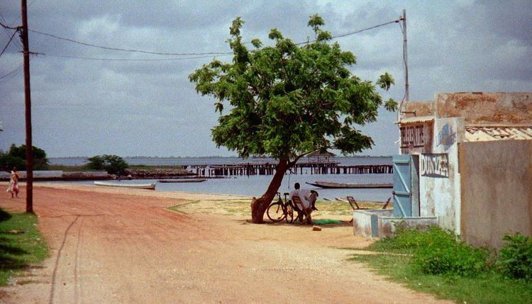
Foundiougne is a main hub on the Sine-Saloum river in the Fatick Region of Senegal. It is a popular launch pad for eco-tours to see the abundant mangroves along the river. A ferry (connecting Foundiougne to the main road leading to Fatick) crosses the river at set times throughout the day transporting locals and tourists alike. Services that can be found include a post office, hospital, grocery stores, a pharmacy, restaurants, an internet cafe, and hotels. A high school in town serves Foundiougne and Mbam. There is a market every Tuesday (called a luma) on the edge of town, near the road to Mbam. At the weekly Luma, residents can purchase anything that they might require, ranging from plastic buckets to cooking pots to fabric to sandals to western clothing. It is an important center for residents of nearby villages, who travel to Foundiougne often on horse-drawn chariots.

There are five communes in the department: Foundiougne, Passy, Sokone, Soum and Karang Poste.

The rural districts (communautés rurales) comprise:

  • Arrondissement of Djilor:
  • Diossong
  • Djilor
  • Niassène
  • Diagane Barka
  • Mbam
  • Arrondissement of Niodior:
  • Bassoul
  • Dionewar
  • Djirnda
  • Arrondissement de Toubacouta:
  • Keur Saloum Diané
  • Keur Samba Guèye
  • Toubacouta
  • Nioro Alassane Tall
  • Historic sites

    Foundiougne and Sokone towns
  • Cannons (2) installed along the arm of the sea at Ndakhonga, north of Foundiougne
  • Prefecture building
  • Mosque of El Hadj Amadou Dème at Sokone
  • Djilor
  • Site of Laga Ndong, at Ndorong-Log, fangool of the Sereer pantheon
  • Pecc, place of the cult of the Gelwars of Saloum
  • Niodior
  • 149 tumuli (Ndiamon-Badat) near Dionewar
  • 17 tumuli (Apetch) near Dionewar
  • Tumuli (Fandanga) near Niodior
  • 26 tumuli (Ndiouta-Boumak) near Niodior
  • 12 tumuli (Ndafafé) at Falia
  • 168 and 54 tumuli (Tioupane-Boumak and Tioupane-Boundaw) at Falia
  • 17 tumuli (Sandalé Déralé) near Diogane
  • 4 tumuli (Mbar Fagnick) near Diogane
  • 6 tumuli near the Bakhalou
  • 77 tumuli of the left bank of the river Djombos
  • Toubacouta
  • 125 tumuli (Dioron-Boumak) near Toubacouta, on the west bank of the Bandiala
  • 12 tumuli (Dioron-Boundaw) 1.5 km south of above
  • 14 tumuli south-west of above
  • 63 tumuli on the north bank of the fork of the Bossinka
  • 30 tumili (Bandiokouta) on the right bank of an arm of the fork of the Bossinka
  • 72 tumuli on the right bank of the Oudiérin
  • 33 tumuli at Soukarta, on farmland near the Bandiala
  • References

    Foundiougne Department Wikipedia