
Country Norway District Namdalen Area rank 196 in Norway Area 544.6 km² Local time Wednesday 10:35 AM | County Nord-Trøndelag Administrative centre Dun Demonym(s) Fosnesbygg Population 653 (2011) Official language form Bokmål | |
 | ||
Weather 3°C, Wind W at 31 km/h, 85% Humidity Points of interest Ølhammarstranda, Steinsjøvika, Sanden, Saltbuvalen, Brennhauglandet, Ålstranda | ||
Fosnes is a municipality in Nord-Trøndelag county, Norway. It is part of the Namdalen region. The administrative centre of the municipality is the village of Dun on the island of Jøa. Other villages include Salsnes and Nufsfjord.
Contents
- Map of Fosnes Norway
- General information
- Name
- Coat of arms
- Churches
- Geography
- Government
- Municipal council
- References
Map of Fosnes, Norway
General information
Fosnes was established as a municipality on 1 January 1838 (see formannskapsdistrikt). On 1 January 1871, the western district of Fosnes (population: 1,472) was separated to form the new municipality of Flatanger. This left Fosnes with 2,655 residents. On 1 January 1889, a small area of Fosnes (population: 61) was transferred to the neighboring municipality of Vikten. Then on 1 January 1913, the western part of Fosnes (population: 1,631) was separated to form the new municipality of Otterøy. This left the much smaller municipality with 1,107 residents. On 1 January 1964, the Finnanger area of Fosnes on the island of Otterøya (population: 116) was transferred to the new municipality of Namsos.
Name
The municipality (originally the parish) is named after the old Fosnes farm (Old Norse: Fólgsnnes), since the first church was built there. The first element is fólgsn which means "hiding place" and the last element is nes which means "headland". (The first element is referring to an inlet behind the farm, where ships could not be seen from the main fjord.) Historically, the name was spelled Fosnæs.
Coat-of-arms
The coat-of-arms is from modern times; they were granted on 13 November 1992. The arms show a black oarlock from a rowing boat on a yellow background. Fosnes is a coastal municipality and rowing boats were the main form of transportation in the former centuries.
The first proposal for arms of Fosnes were taken in 1989, when the council launched a contest to develop arms. Several proposals were received but none was acceptable to or the council, or the Norwegian Heraldic Society, as the proposals were not made according to heraldic rules. Finally the Society proposed the above arms, which were acceptable to the council.
Churches
The Church of Norway has one parish (sokn) within the municipality of Fosnes. It is part of the Namdal deanery in the Diocese of Nidaros.
Geography
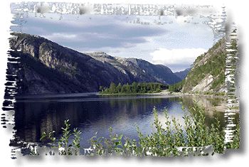
Fosnes is a coastal municipality located along the Foldafjord, north of the town of Namsos. The municipality includes the island of Jøa, part of the island of Elvalandet, and part of the mainland. The second deepest lake in Europe, Salsvatnet, and the lake Mjosundvatnet are both located in the eastern part of the municipality.
Government
All municipalities in Norway, including Fosnes, are responsible for primary education (through 10th grade), outpatient health services, senior citizen services, unemployment and other social services, zoning, economic development, and municipal roads. The municipality is governed by a municipal council of elected representatives, which in turn elect a mayor.
Municipal council
The municipal council (Kommunestyre) of Fosnes is made up of 13 representatives that are elected to every four years. Currently, the party breakdown is as follows: