
Population 480 (2011) Sovereign state United Kingdom Local time Wednesday 9:26 AM | OS grid reference TF316331 Post town Boston Dialling code 01205 | |
 | ||
Weather 11°C, Wind W at 11 km/h, 80% Humidity | ||
Fosdyke is a village and civil parish in the Borough of Boston, Lincolnshire, England. The population of the civil parish at the 2011 census was 480. It is situated approximately 7 miles (11 km) south from Boston, just off the A17, and 2 miles (3.2 km) east from the junction of the A17 with the A16.
Contents
Map of Fosdyke, Boston, UK
History
The name derives from the Old English and Old Norse "fotrs dic", meaning Fotr's (personal name) ditch.
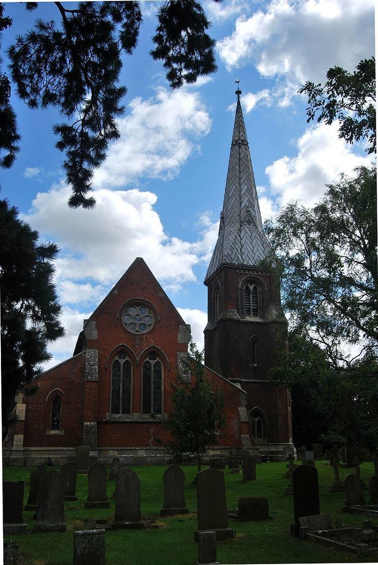
Fosdyke's Grade II listed Anglican church is dedicated to All Saints. In 1871-72 the church was entirely rebuilt in brick on the site of an older church, in an Early English style. In 1885 Kelly's Directory reported the existence of a Primitive Methodist chapel, a coastguard station, and a 100-year-old almshouse, founded Sir Thomas Middlecott for the Fosdyke and Algarkirk parishes.
Geography
The village is near the mouth of the River Welland, and the parish extends across the river to include both ends of the hamlet of Fosdyke Bridge.
Fosdyke Wash, the marshy area at the mouth of the Welland, is shown by Ordnance Survey as the nearest coastal location to Coton in the Elms in Derbyshire, which is the furthest point from the sea in Great Britain, 70 miles (113 km) away.
Fosdyke is one of eighteen civil parishes which, together with Boston, form the Borough of Boston local government arrangement, in place since a reorganisation of 1 April 1974 which resulted from the Local Government Act 1972. Fosdyke parish forms part of the Five Villages electoral ward, along with Algarkirk, Bicker, Sutterton and Wigtoft. Hitherto, the parish had formed part of Boston Rural District in the Parts of Holland. Holland was one of the three divisions (formally known as parts) of the traditional county of Lincolnshire. Since the 1888 Local Government Act Holland had been, in most respects, a county in itself.
Community
Fosdyke has a village hall. There are no shops, and the nearest post office is in Sutterton. The only remaining public house close to the village is The Ship at Fosdyke Bridge; other pubs in the local area have closed. The only establishment within the village now providing alcoholic drinks is the Fosdyke Sports & Social Club, with facilities for pool, poker and darts. The playing field, used by Fosdyke Football Club, has an enclosed multisport area (opened in 2009), used for five-a-side football, basketball and volleyball. Adjacent to the social club building is a children's adventure playground. Situated at the end of the playing field is a bowls club, which moved to Fosdyke in 1991. Businesses include builders, handymen, and producers of fruit and vegetables.
Next to Fosdyke Bridge and The Ship public house is the privately owned Fosdyke Yacht Haven, a pleasure boat marina and boat yard, developed from a previous commercial port. The marina has dry land facilities for sailing craft.