
Area 1,816 acres (7.35 km) Phone +1 770-867-3489 | ||
 | ||
Address 210 S Broad St, Winder, GA 30680, USA Hours Open today · 7AM–10PMWednesday7AM–10PMThursday7AM–10PMFriday7AM–10PMSaturday7AM–10PMSunday7AM–10PMMonday7AM–10PMTuesday7AM–10PM Similar Victoria Bryant State Park, Red Top Mountain State Park, Tugaloo State Park, Fort Mountain State Park, A H Stephens Historic P | ||
Gopro fort yargo state park winder hiking georgia trails
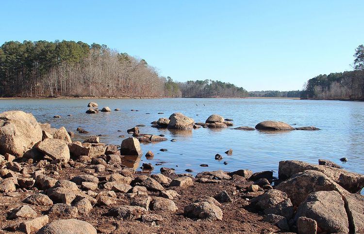
Fort Yargo State Park is a 1,816 acre (7.34 km²) Georgia state park located in Winder, situated between Athens and Atlanta. The park features a log fort built in 1792 by settlers for protection against Creek and Cherokee Indians. There is a 260 acre (1.05 km²) lake with public Beach. The park also hosts Camp Will-A-Way, an accessible camp designed for individuals with developmental disabilities, in partnership with Camp Twin Lakes.
Contents
- Gopro fort yargo state park winder hiking georgia trails
- History and LegendsEdit
- DescriptionEdit
- Old Fort YargoEdit
- Camp Will A WayEdit
- FacilitiesEdit
- References
History and LegendsEdit
Fort Yargo has been a part of Winder history for over 200 years and is situated on land that was formed border between the Creek and Cherokee nations.
The Creek village known as Snodon was located near what is now Athens and Church streets. A Creek named Umausauga claimed an area south of Tishmagu, now called Mulberry River. In 1786, three men - Abednego Moore, Richard Easley, and Josiah Strong - arrived from Effingham County. They set up camp north of the Mulberry River in hopes of trading beads and cloth. The three men formed a friendship with Umasauga, who allowed the men to purchase some of his land which they called Beadland. The day after the trade nine friends and family joined the three men. They brought four horses, two wagons, four head of cattle, four sheep, six pigs, ten new rifles with powder and shot and tools. The new colony now had eight men and four women, six of whom had fought in the Revolution.
The State of Georgia contracted with the Humphries Brothers to build four forts across Georgia to protect white settlers from the Indians: Fort Strong at Talassee, Fort Thomocoggan at Jefferson, Fort Groaning Rock at Commerce, and Fort Yargo at Beadland. In 1792, Fort Yargo was constructed in Beadland. The fort was inhabited by the small group of settlers who were well armed and ready to aide their neighbors.
In 1810 George Humphrey, an original builder of the Fort, sold Fort Yargo and 121 surrounding acres at auction to John Hill for $167.00. John Hill and his family lived on the property for a number of years. The family cemetery is located in the Fort Yargo State Park.
In the year 1927, the Daughters of the American Revolution (DAR) took on the project to restore and preserve Fort Yargo. Mildred Pledger and the DAR placed a marker on the grounds which was later destroyed. Led by C.O. Maddox, members of the Kiwanis Club and the Lions Club set out to preserve the fort. With the help of Senator Richard B. Russell, Jr. in 1954, 1,497 acres were donated to the state. Other lands were acquired to bring the acreage count to 1,814 acres.
DescriptionEdit
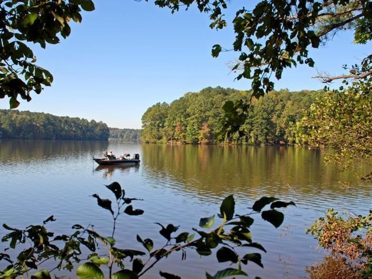
Local citizens and the Fort Yargo Living History Society are working today to restore Fort Yargo and some out buildings. Scheduled living history dates provide visitors with a chance to learn more about the history of the site. Fort Yargo provides space for multiple activities including GeoCaching, hiking and mountain biking, disc golf, boating, including Jon boat, pedal boat, and canoe rentals, lake swimming, fishing, picnicking, miniature golf, tennis, and basketball. The Fort allows for weddings, but they must have prior park approval. The park is located 1 mile south of Winder and is accessible by Georgia State Route 81.
Old Fort YargoEdit
The Fort Yargo building constructed as part of the original Fort is an 18 by 22 feet two-story log blockhouse. The logs used to construct the Fort are around 10 inches thick and are joined at the corners by interlocking wedge shaped notches. Portholes are located on the Fort to aide defense.
Camp Will-A-WayEdit
Camp Will-A-Way is provided by Camp Twin Lakes and the Georgia Department of Natural Resources. Opened in 1971, the camp provides a 250 bed camping facility to provide for the special needs population.