
Country United States FIPS code 56-28665 Elevation 1,698 m Zip code 82514 Area code 307 | Time zone Mountain (MST) (UTC-7) GNIS feature ID 1609092 Area 54.1 km² Population 1,759 (2010) | |
 | ||
Fort Washakie is a census-designated place (CDP) in Fremont County, Wyoming, United States, within the Wind River Indian Reservation and along U.S. Route 287. The population was 1,759 at the 2010 census.
Contents
Map of Fort Washakie, WY, USA
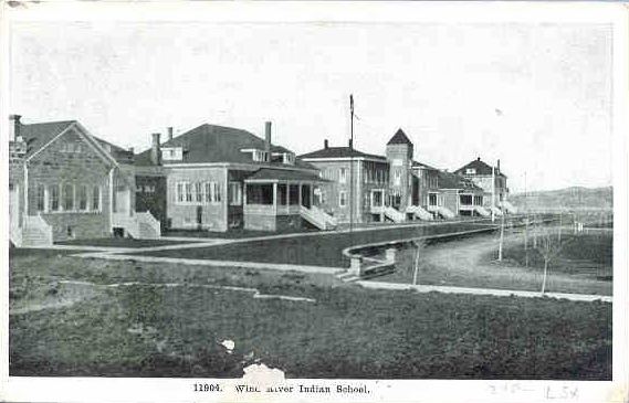
Fort Washakie is named after nearby Fort Washakie, a U.S Army post established in 1869 and named after Chief Washakie in 1878.
Geography
Fort Washakie is located at 42°59′57″N 108°54′42″W (42.999137, -108.911782). It is in the foothills of the Wind River Range and just east of the Continental Divide.
According to the United States Census Bureau, the CDP has a total area of 20.9 square miles (54.2 km²), none of which is covered with water.
Demographics
As of the census of 2000, there were 1,477 people, 432 households, and 333 families residing in the CDP. The population density was 70.6 people per square mile (27.3/km²). There were 493 housing units at an average density of 23.6/sq mi (9.1/km²). The racial makeup of the CDP was 92.62% Native American (mostly Eastern Shoshone), 5.89% White, 0.07% African American, 0.68% from other races, and 0.74% from two or more races. Hispanic or Latino of any race were 3.25% of the population.
There were 432 households out of which 45.4% had children under the age of 18 living with them, 39.6% were married couples living together, 29.4% had a female householder with no husband present, and 22.7% were non-families. 19.2% of all households were made up of individuals and 5.3% had someone living alone who was 65 years of age or older. The average household size was 3.29 and the average family size was 3.75.
In the CDP, the population was spread out with 37.2% under the age of 18, 9.1% from 18 to 24, 28.7% from 25 to 44, 16.1% from 45 to 64, and 8.8% who were 65 years of age or older. The median age was 27 years. For every 100 females there were 101.5 males. For every 100 females age 18 and over, there were 96.0 males.
The median income for a household in the CDP was $18,906, and the median income for a family was $20,658. Males had a median income of $23,295 versus $22,885 for females. The per capita income for the CDP was $7,700. About 42.9% of families and 42.7% of the population were below the poverty line, including 45.8% of those under age 18 and 52.0% of those age 65 or over.
Education
Public education in the community of Fort Washakie is provided by Fremont County School District #21.