
Country Canada Elevation 43 m Population 792 (2011) Area code 867 | Hamlet 1 November 1986 Area 53.39 km² Local time Tuesday 9:21 PM | |
 | ||
Weather -21°C, Wind N at 10 km/h, 69% Humidity | ||
Fort McPherson (Gwich’in language: Teet'lit Zheh at the head of the waters) is a hamlet located in the Inuvik Region of the Northwest Territories, Canada. It is located on the east bank of the Peel River and is 121 km (75 mi) south of Inuvik on the Dempster Highway.
Contents
- Map of Fort McPherson NT Canada
- History
- National Historic Site
- Transportation
- Demographics
- Climate
- References
Map of Fort McPherson, NT, Canada
The two principal languages spoken are Gwich'in and English.
Originally the site of a Hudson's Bay Company post the community was named for "Murdoch McPherson".
The Gwich’in people of Fort McPherson are very welcoming of strangers and go out of their way to make them welcome. Most people have vehicles and regularly make trips to either Inuvik, or Whitehorse.
History
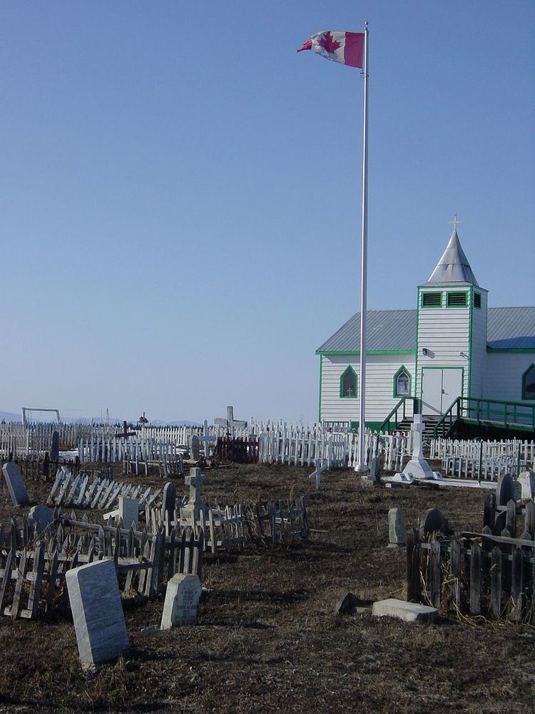
Fort McPherson was the starting point of Francis Joseph Fitzgerald's famous tragic journey of "The Lost Patrol". All four men on the Patrol, including Fitzgerald, were buried at Fort McPherson on 28 March 1911. In 1938, the graves were cemented over into one large tomb (to the right of the flag pole in above image), with cement posts at the four corners connected by a chain. In the centre is a memorial to the Royal Northwest Mounted Police Patrol of 1910.
National Historic Site
In 1969, the area comprising the boundaries of the community of Fort McPherson, as it was mapped in 1898, was designated a National Historic Site of Canada, in recognition of the fact that the site had served as the principal Hudson's Bay Company trading post in the MacKenzie Delta region for over 50 years, and had been the first North-West Mounted Police post in the Western Arctic.
Transportation
Fort McPherson is accessible by road all year from Dawson City and Whitehorse, Yukon, with the exception of spring break-up and fall freeze-up on the Peel River. The community also has access to Inuvik via the Dempster Highway and crosses the Mackenzie River at Tsiigehtchic.
There is also a small airport at Fort McPherson, Fort McPherson Airport, that has seasonal flights to Inuvik (Mike Zubko) Airport on Aklak Air when the road across the Peel is closed. The former Fort McPherson Water Aerodrome was listed as closed in the 15 March 2007 Canada Flight Supplement.
Demographics
Population is 792 according to the 2011 Census, a 2.1% increase over the 2006 Census count of 776. In 2012 the Government of the Northwest Territories reported that the population was 808 with an average yearly growth rate of -0.2% from 2001. In the 2006 Census 715 people identified as aboriginal, 650 as North American Indian, 30 as Métis, 30 as Inuit or Inuvialuit, 10 giving multiple or other aboriginal responses and 55 Non-Aboriginal.
Climate
Fort McPherson experiences a subarctic climate. The highest temperature ever recorded in Fort McPherson was 33.3 °C (92 °F) on 7 August 1919 and 20 July 2001. The coldest temperature ever recorded was −55.6 °C (−68 °F) on 14 January 1894.