
Country United States County Pulaski Population 13,667 (2000) | State Missouri Time zone Central (CST) (UTC-6) | |
 | ||
Area 252.8 km² (251.7 km² Land / 6.216 km² Water) | ||
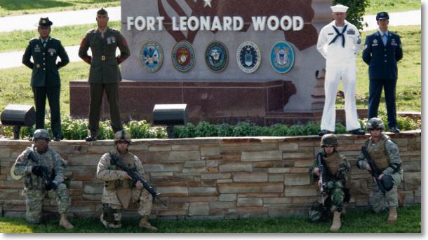
Fort Leonard Wood is a census-designated place (CDP) in Pulaski County, Missouri, United States. The population was 13,667 at the 2000 census. It is named in honor of Major General Leonard Wood, who was awarded the Medal of Honor. The Fort Leonard Wood Micropolitan Statistical Area comprises Pulaski County.
Contents
- Map of Fort Leonard Wood MO USA
- Geography
- Demographics
- Transportation
- Media
- School Districts
- New Years Eve tornado
- References
Map of Fort Leonard Wood, MO, USA
Geography
Fort Leonard Wood is located at 37°44′17″N 92°7′2″W (37.738191, -92.117275).
According to the United States Census Bureau, the CDP has a total area of 97.6 square miles (252.8 km²), of which, 97.2 square miles (251.7 km²) of it is land and 2.4 square miles (1.1 km²) of it (0.43%) is water.
Demographics
As of the census of 2000, there were 13,667 people, 2,639 households, and 2,335 families residing in the CDP. The population density was 140.6 people per square mile (54.3/km²). There were 3,151 housing units at an average density of 32.4/sq mi (12.5/km²). The racial makeup of the CDP was 64.8% White, 21.6% African American, 1.1% Native American, 2.4% Asian, 0.5% Pacific Islander, 5.0% from other races, and 4.7% from two or more races. Hispanic or Latino of any race were 11.4% of the population.
There were 2,639 households out of which 71.5% had children under the age of 18 living with them, 80.0% were married couples living together, 5.8% had a female householder with no husband present, and 11.5% were non-families. 7.0% of all households were made up of individuals and none had someone living alone who was 65 years of age or older. The average household size was 3.32 and the average family size was 3.54.
In the CDP, the population was spread out with 27.8% under the age of 18, 35.0% from 18 to 24, 35.8% from 25 to 44, 1.3% from 45 to 64, and 0.1% who were 65 years of age or older. The median age was 21 years. For every 100 females there were 158.3 males. For every 100 females age 18 and over, there were 181.4 males.
The median income for a household in the CDP was $33,891, and the median income for a family was $34,354. Males had a median income of $24,732 versus $20,421 for females. The per capita income for the CDP was $11,652. About 2.7% of families and 4.1% of the population were below the poverty line, including 4.6% of those under age 18 and none of those age 65 or over.
Transportation
Waynesville Regional Airport at Forney Field serves the community with air service; even though it's on Fort Leonard Wood, it is jointly run by the cities of Waynesville and St. Robert and is available for civilian use by private pilots and scheduled commercial passenger service. Many pilots (especially inexperienced pilots) may choose an alternative nearby private airport to avoid the military right of way and maneuvering this tiny airport in the presence of larger aircraft.
The major east-west route is Interstate 44. Springfield, MO is 88 miles to the southwest, and St. Louis, Mo is 133 miles to the northeast. Before I-44, the main highway was U.S. Route 66, which still exists as a scenic route through the area and passes through Devil's Elbow, St. Robert, Waynesville, Buckhorn, and Hazelgreen. Names for U.S. Route 66 vary - at different places, it's called Teardrop Road, Highway Z, Old Route 66, Historic Route 66, and Highway 17. State-posted signs mark most of the alignment of the road.
Major north-south routes include:
Major attractions along U.S. Route 66 include the Old Stagecoach Stop in downtown Waynesville, which is now a museum but began as a tavern and boarding house and is the oldest standing structure in the county. It was used as a Civil War hospital for Union troops who were garrisoned above the city in Fort Wayne, which was demolished after the war. The Old Courthouse Museum in downtown Waynesville is near the Old Stagecoach Stop. Three bridges cross the Big Piney River at Devil's Elbow—the modern Interstate 44 bridge, the later U.S. Route 66 alignment on Highway Z that was made possible by the Hooker Cut through a steep hillside, and the original U.S. Route 66 alignment on Teardrop Road that includes a historic bridge that's in the process of renovation. The Elbow Inn is a biker bar that's a frequent stop on the original U.S. Route 66 alignment.
Media
Fort Leonard Wood is in Pulaski County and a high percentage of military personnel live off post in surrounding communities, especially St. Robert and Waynesville but also the farther-out cities of Richland, Crocker, and Dixon, and the unincorporated communities of Laquey, Swedeborg and Devil's Elbow, all of which have a lower housing cost than nearer housing in St. Robert and Waynesville. Military personnel assigned to training areas on the south end of the post sometimes choose to live in the unincorporated areas of Big Piney and Palace in Pulaski County, or the northern Texas County communities of Plato and Roby.
The area has one daily and three weekly print newspapers, as well as an online internet daily newspaper. The county also has two internet discussion sites, the Pulaski County Web and Pulaski County Insider.
KFBD-FM and its AM sister station, KJPW, are the dominant news radio providers in the Pulaski County area, which includes Fort Leonard Wood, Waynesville, and St. Robert. These stations compete with the only other station broadcasting from Pulaski County, KFLW Radio, owned by the Lebanon Daily Record [1] and working locally from the St. Robert offices of the Pulaski County Mirror [2] weekly newspaper.
The content of the weekly Fort Leonard Wood Guidon [3] is produced under the auspices of Army Public Affairs at Fort Leonard Wood but printed under contract by the Springfield News-Leader,[4] a Gannett-owned [5] newspaper which produces and sells advertisements in the Fort Leonard Wood Guidon.
The Daily Guide, commonly known as the Waynesville Daily Guide [6] but based in St. Robert and serving the entire county, is owned by Gatehouse Media [7] and is the central printing plant for three other Gatehouse newspapers in nearby counties, the daily Camden Lake Sun Leader [8] and Rolla Daily News [9] as well as the weekly St. James Leader-Journal.[10]
The weekly Pulaski County Mirror [11] is owned by the Lebanon Daily Record,[12] a family owned newspaper in an adjoining county. The paper is a merger of the Richland Mirror and Pulaski County Democrat in St. Robert, which were separate weekly papers owned by the Lebanon Daily Record until their owner merged them in 2009.
The weekly Dixon Pilot [13] is privately owned by a resident of Dixon.
The Pulaski County Daily News [14] internet newspaper is privately owned by a St. Robert resident.
The Pulaski County Insider [15] is run by a group of St. Robert and Waynesville residents and maintained and hosted by a Potosi resident.
The Pulaski County Web [16] is run and maintained by a Devil's Elbow resident.
A PBS show called "Postcards from Buster" created a 30-minute video of Fort Leonard Wood, Missouri.
School Districts
Seven main school districts are fully or partly within the borders of Pulaski County, not counting two small districts which are mostly within other counties and only have only a few dozen residents within Pulaski County. All seven school districts have a high percentage of Fort Leonard Wood military dependents, and over two-thirds of Waynesville students fall into that category.
The cities of Waynesville and St. Robert and the Fort Leonard Wood army installation, along with their surrounding rural areas running east to Devil's Elbow, are served by the Waynesville R-VI School District which is by far the largest in the county.
The cites of Richland, Crocker, and Dixon, along with their surrounding rural areas, are served by the Richland R-IV School Disrrict, the Crocker R-II School District and the Dixon R-I School District. The Richland and Dixon districts both extend into rural parts of adjacent counties.
The unincorporated communities of Laquey and Swedeborg are served by the Laquey R-V School District and the Swedeborg R-III School District. Swedeborg is the county's last remaining K-8 district and most of its high school students attend Richland High School though some attend Crocker High School or Waynesville High School; all others serve students running from kindergarten through high school.
The areas south of Fort Leonard Wood, including the unincorporated Pulaski County communities of Big Piney and Palace, is served by the Plato R-V School District, which is based in the northern Texas County village of Plato but also includes parts of Pulaski, Laclede and Wright counties.
New Years Eve tornado
On the morning hours of December 31, 2010, an EF3 tornado ripped through the army base town. The tornado caused extensive damage and destroyed over 150 homes. The tornado took out power and cut off water supply. There were only minor injuries.