
Type Military base In use 1863–1890 Area 3 ha Phone +1 541-381-2230 | Materials wood Year built 1863 | |
 | ||
Hours Closed now Tuesday9AM–5PMWednesday9AM–5PMThursday9AM–5PMFriday9AM–5PMSaturday9AM–5PMSundayClosedMondayClosed Similar Cascade Range, Klamath County Museums, Baldwin Hotel, Captain Jack's Stronghold, Collier Logging Museum | ||
Driving to crater lake oregon route 62 chiloquin fort klamath south rim
Fort Klamath was a military outpost near the western end of the Oregon Trail, between Crater Lake National Park and Upper Klamath Lake in Klamath County, Oregon, United States. The Fort Klamath Site, about a mile southeast of the present community of Fort Klamath, Oregon, is listed on the U.S. National Register of Historic Places
Contents
- Driving to crater lake oregon route 62 chiloquin fort klamath south rim
- Fort klamath fall 2016
- History
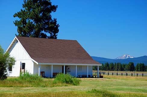
- Fort Klamath Museum
- References
Fort klamath fall 2016
History
Fort Klamath was established in 1863, and was an important Army post during conflicts with the Klamath, Modoc, and Northern Paiute tribes. The fort consisted of more than 50 buildings, including a sawmill. Four Modoc men, led by Kintpuash, were executed there in 1873 for the killing of General Edward Canby. Their graves remain at the fort.
A post office was opened in 1879. By the mid-1880s, the settlers in the area no longer needed protection, and in 1889 the decision was made to close the fort. After a harsh final winter with more than 20 feet (6 m) of snow, the troops of Company I of the 14th Infantry Regiment left the fort on June 23, 1890, and moved to Vancouver Barracks.
Fort Klamath Museum
An 8-acre (32,000 m2) parcel within the fort area is maintained as a park and museum by Klamath County, Oregon. The Fort Klamath Museum is housed in a modern structure designed after the fort's guardhouse and standing in the original guardhouse location.
The Fort Klamath site was added to the National Register of Historic Places in 1971.