
Area rank 139 in Norway Population 1,208 (2015) | Administrative centre Forsand Demonym(s) Forsandbu Local time Wednesday 1:01 AM | |
 | ||
Weather 0°C, Wind SW at 18 km/h, 85% Humidity Area 780 km² (701.3 km² Land / 78.75 km² Water) Points of interest | ||
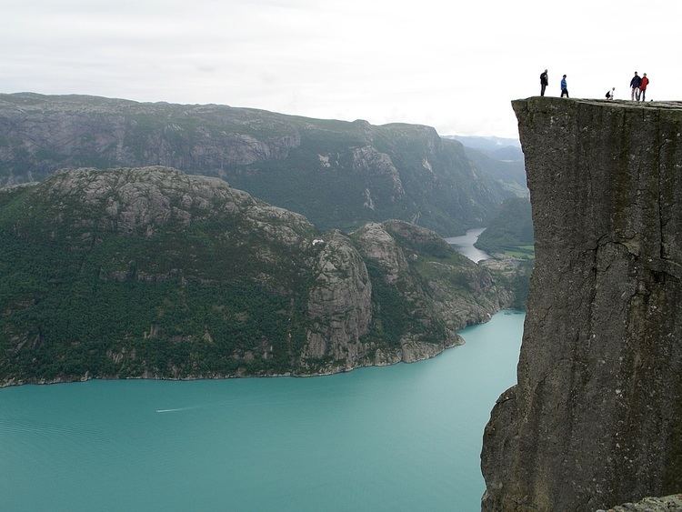
Preikestolen the pulpit rock cliff in forsand norway best travel destination
Forsand is a municipality in Rogaland county, Norway. It is located in the traditional district of Ryfylke. The administrative centre of the municipality is the village of Forsand. Other villages in the municipality include Lysebotn, Øvre Espedal, Oanes, Kolabygda, and Fløyrli.
Contents
- Preikestolen the pulpit rock cliff in forsand norway best travel destination
- Map of Forsand Norway
- Auto trip on amazing norwegian roads forsand odda
- General information
- Name
- Coat of arms
- Churches
- Geography
- Government
- Municipal council
- References
Map of Forsand, Norway
Forsand municipality surrounds the famous Lysefjorden and it lies on the east side of the Høgsfjorden. It is one of largest municipalities within the county of Rogaland in terms of area, and one of the smallest in terms of population. Forsand municipality covers 780 square kilometres (300 sq mi) and has a population of 1,208 (as of 2015). In 1999, evidence of a population here dating back to around 7500 BC was located.
Auto trip on amazing norwegian roads forsand odda
General information
The municipality of Fossan was established on 1 January 1871 when the very large municipality of Høgsfjord was divided into two: Fossan (located east of the Høgsfjorden and south of the Frafjorden) and Høle (located west of the Høgsfjorden). Initially, Fossan had 2,081 residents. On 1 January 1965, the municipality was split, with everything located south and east of the Frafjorden being transferred to the neighboring municipality of Gjesdal. This area had no road connection with the rest of Forsand, but it was connected by road to Gjesdal.
Name
The municipality (originally the parish) is named after the old Forsand farm (Old Norse: Forsandr), since the first Forsand Church was built there. The first element is the prefix for which means "outsticking" and the last element is sandr which means "sand" or "sandy beach". Before 1918, the name was written "Fossan".
Coat-of-arms
The coat-of-arms is from modern times. They were granted on 11 March 1988. The arms show a white heron on a green background. They were designed by John Digernes to represent a common bird in the area.
Churches
The Church of Norway has one parish (sokn) within the municipality of Forsand. It is part of the Ryfylke deanery in the Diocese of Stavanger.
Geography
Forsand is a large municipality that is very mountainous with a long, narrow fjord running through the middle from east to west. The Lysefjorden is surrounded by very steep 1,000-metre (3,300 ft) tall cliffs such as Kjerag and Preikestolen, with the Lysefjord Bridge crossing the fjord near the western end. The famous Kjeragbolten boulder and Kjeragfossen waterfall are located along the inner part of the fjord. The village of Lysebotn lies at the eastern end of the fjord. The lake Nilsebuvatnet is located high up in the mountains, north of Lysebotn on the border of Strand and Forsand municipalities. It is regulated for hydroelectric power use at the Lysebotn Hydroelectric Power Station.
Government
All municipalities in Norway, including Forsand, are responsible for primary education (through 10th grade), outpatient health services, senior citizen services, unemployment and other social services, zoning, economic development, and municipal roads. The municipality is governed by a municipal council of elected representatives, which in turn elect a mayor.
Municipal council
The municipal council (Kommunestyre) of Forsand is made up of 17 representatives that are elected to every four years. For 2011–2015, the party breakdown is as follows: