
Airport type Public 18/36 3,014 Elevation 76 m | Owner City of Forrest City Elevation AMSL 249 ft / 76 m 3,014 919 Phone +1 870-633-4511 | |
 | ||
Address 1296 State Hwy 980, Forrest City, AR 72335, USA Similar Forrest City Muni, Marianna County‑St Edwards, Tunica Airport, Tunica Air Inc, West Memphis Municipal | ||
Forrest City Municipal Airport (IATA: FCY, ICAO: KFCY, FAA LID: FCY) is a city-owned public-use airport located four nautical miles (5 mi, 7 km) south of the central business district of Forrest City, in St. Francis County, Arkansas, United States. This airport is included in the FAA's National Plan of Integrated Airport Systems for 2011–2015, which categorized it as a general aviation facility.
Facilities and aircraft
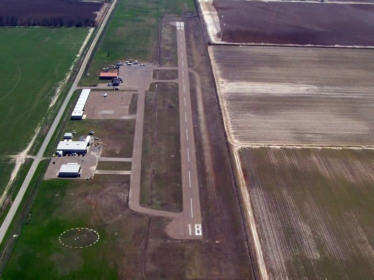
Forrest City Municipal Airport covers an area of 80 acres (32 ha) at an elevation of 249 feet (76 m) above mean sea level. It has one runway designated 18/36 with an asphalt surface measuring 3,014 by 50 feet (919 x 15 m). For the 12-month period ending July 31, 2010, the airport had 44,300 aircraft operations, an average of 121 per day: 99% general aviation and 1% military.