
Time zone WET (UTC+0) Area 199 km² | Irish Grid Reference N453738 | |
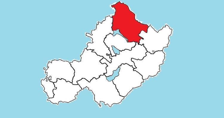 | ||
Fore (Irish: Baile Fhobhair) is a barony in northern County Westmeath, Ireland. It was formed by 1672.
Contents
Geography
Fore has an area of 49,056 acres, making it the largest barony in Westmeath but placing it among the smaller baronies in Ireland. Mullaghmeen, the highest point in Westmeath is located in Fore and at 261 metres (856 ft) is the lowest county high point in Ireland. The barony contains three large lakes, Lough Derravaragh, Lough Sheelin and Lough Lene and the River Inny flows through the barony before it connects to the River Shannon. The barony borders the counties of Cavan, Longford and Meath.
Civil parishes of the barony
This table lists an historical geographical sub-division of the barony known as the civil parish (not to be confused with an Ecclesiastical parish).
Towns and villages
Places of Interest
References
Fore (barony, County Westmeath) Wikipedia(Text) CC BY-SA