
Population 211 (2011) | Postcode(s) 4343 Postal code 4343 | |
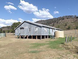 | ||
Fordsdale is a locality in the Lockyer Valley Region of South East Queensland, Australia. At the 2011 Australian Census Forsdale and surrounds recorded a population 211.
Contents
Map of Fordsdale QLD 4343, Australia
Geography
The terrain in the area is rugged. Lower areas along the creeks have been farmed while the steep and elevated parts remain vegetated. Silky Oak Creek joins Ma Ma Creek, a tributary of Lockyer Creek at Fordsdale. Dwyers Scrub Regional Park has been established in the west.
References
Fordsdale, Queensland Wikipedia(Text) CC BY-SA