
Population 211 (2011) Postal code 4347 | Postcode(s) 4347 | |
 | ||
Mount Whitestone Upper TenthillCafeyMount Sylvia | ||
Mount Whitestone is a locality in the Lockyer Valley Region of South East Queensland, Australia. At the 2011 Australian Census Mount Whitestone and surrounds recorded a population of 211.
Map of Mount Whitestone QLD 4347, Australia
In the south elevations rise to around 690 metres above sea level near Paradise Mountain. The summit of Mount Whitestone itself is centrally located and reaches 530 m. To the north of the peak Paradise Creek joins Ma Ma Creek. Both of these waterways drain valleys extending southwards on either side of Mount Whitestone.
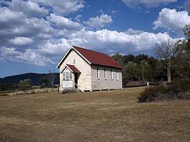
Mount Whitestone State School was established in 1886.
References
Mount Whitestone, Queensland Wikipedia(Text) CC BY-SA