
OS grid reference NZ045935 | ||
 | ||
Similar Whittle Dene, Balderhead Reservoir, Scotsgap railway station, Grassholme Reservoir, Hury Reservoir | ||
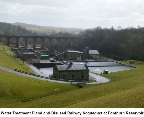
Fontburn is a drinking water reservoir situated 10 miles (16 km) northwest of the market town of Morpeth in Northumberland, England.
Contents
Map of Fontburn Reservoir, Morpeth, UK
History
The reservoir was built at the end of the 19th century to provide drinking water for parts of southeast Northumberland.
Flora and fauna
The north shore is mainly vegetated with scrub and woodland, including willow, blackthorn, elder, birch, hawthorn, and hazel. Common spotted orchids grow in the base-rich flushed areas. At the extreme south eastern corner of the site there is an area of marshy grassland with abundant meadow-sweet, wild angelica, common knapweed, and sneezewort and where there is periodic flooding of the shore you can also find species like common spike rush, reed canary grass, lesser spearwort, and amphibious bistort.
The presence of four British reptiles; common lizard, adder, slow worm, and grass snake, and five of Britain’s native amphibians; common frog, common toad, smooth newt, palmate newt, and great crested newt mean that this an extremely valuable and important wildlife site. The grass snake records for Fontburn make this one of the most northerly authenticated colonies of this species in Britain.
Fishing
The reservoir is regularly stocked with trout and is a favoured place with fresh water anglers.
Ancient monuments
Close to the reservoir there are ancient Bronze Age sites which are easily reached on foot. The area is also popular with hill walkers.