
Length 106 km | Basin size 568 sq mi (1,470 km) Basin area 1,470 km² | |
 | ||
Main source Lincoln County, Tennessee558 ft (170 m) | ||
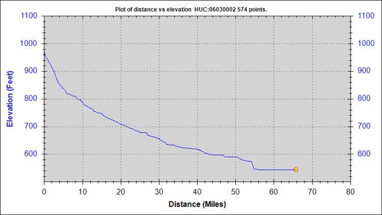
The Flint River, 65.7 miles (105.7 km) long and draining an area of 568 square miles (1,470 km2), is a tributary to the Tennessee River. The river rises in Lincoln County, Tennessee, and flows south into Madison County, Alabama, where most of the river's watershed (342 sq. mi.) is located. The land within this watershed is predominantly agricultural and has experienced significant recent residential growth from the city of Huntsville. The U.S. Geological Survey National Water-Quality Assessment Program is currently investigating water quality in the lower Tennessee River basin with several monitoring activities targeted in the Flint River Basin.
Contents
Map of Flint River, Tennessee, USA
GeologyEdit
The Flint River rises on the southwestern fringe of the Cumberland Escarpment and primarily drains the plains that have been created by the erosion of this fringe of the Appalachians. Due to the sedimentary nature of this escarpment, which consists primarily of sandstone, star blue quartz can be found in small quantities in the stream bed because it easily survives weathering of its encasing stone.