
Intercommunality Haut Pays Marchois Area 43.53 km² Population 380 (1999) | Canton Crocq Time zone CET (UTC+1) Local time Monday 5:25 AM | |
 | ||
Weather 7°C, Wind N at 8 km/h, 96% Humidity | ||
Flayat is a commune in the Creuse department in the Nouvelle-Aquitaine region in central France.
Contents
Map of 23260 Flayat, France
Geography
An area of lakes and streams, forestry and farming, comprising the village and several hamlets situated in the upper valley of the river Méouzette some 17 miles (27 km) southeast of Aubusson, at the junction of the D21, D30 and the D996 roads. The commune has an eastern border with the department of Allier and is within the national park of the Millevaches (not 1000 cows, but lakes).
The Chavanon (locally called la Ramade) forms most of the commune's eastern border.
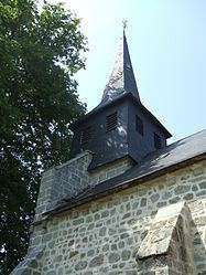
Sights
References
Flayat Wikipedia(Text) CC BY-SA