
Length 113 km | - elevation 915 ft (279 m) - elevation 617 ft (188 m) Basin area 1,450 km² Mouth Grand River | |
 | ||
Bridges | ||
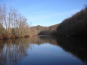
The Flat River is a tributary of the Grand River in the western part of the U.S. state of Michigan. It rises as the outflow of the six lakes (Six Lakes) system in Belvidere Township, west of Edmore in Montcalm County. It flows mostly south and slightly west through Montcalm County, Ionia County, and Kent County, flowing into the Grand River in Lowell. Other cities it flows through along the way include Greenville and Belding.
Map of Flat River, Michigan, USA
Two historic covered bridges cross the river. One, the Fallasburg Bridge, in Vergennes Township, Kent County is in Fallasburg County Park a few miles north of Lowell. The other, Whites Bridge is a few miles to the northeast in adjacent northwest Keene Township, Ionia County, near Smyrna. On July 7, 2013, an arson fire destroyed White's Bridge. Fund-raising efforts are underway in attempt to have the bridge rebuilt. At the time of its destruction, it was the oldest covered bridge of its kind in Michigan.
There are 5 dams along the river: Greenville, Belding, Whites Bridge, Burroughs and Lowell.
It is the river named in the song "Sad Ballad of Jack Haggerty", sometimes known as "Flat River Girl."