
Length 20 km (12 mi) Highest elevation 931 m (3,054 ft) Elevation 931 m | Width 8.5 km (5.28 mi) Highest point Stjerntinden Area 110 km² Municipality Flakstad | |
 | ||
Points of interest The Blacksmith at Sund, Brunstranda | ||
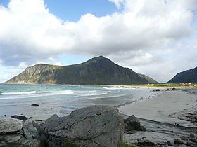
Flakstadøya is an island in the Lofoten archipelago in Nordland county, Norway. It is located in Flakstad municipality with the Vestfjorden on the east side of the island and the Norwegian Sea on the west side of the island.
Contents
Map of Flakstad%C3%B8ya, Flakstad, Norway
Geography
The island is connected to the neighboring island of Moskenesøya (to the south and west) by the Kåkern Bridge and Fredvang Bridges. It is connected to the island of Vestvågøya (to the northeast) through the undersea Nappstraum Tunnel. The European route E10 highway crosses the island and connecting to the neighboring islands.
There are several villages on the island including the administrative centre of the municipality, Ramberg, and others such as Fredvang, Nusfjord, Sund, Vikten, and Napp.
References
Flakstadøya Wikipedia(Text) CC BY-SA