
Meaning of name "flat island" Highest elevation m Country Scotland Island group Slate Islands Lieutenancy area Argyll and Bute | OS grid reference NM720123 Sovereign state United Kingdom Population 0 Council area Argyll and Bute Year first constructed 1860 | |
 | ||
Similar Firth of Lorn, Cara Island, Calve Island, Kerrera, Claig Castle | ||
Fladda is one of the Slate Islands, off the west coast of Argyll and Bute, Scotland.
Contents
Map of Fladda, United Kingdom
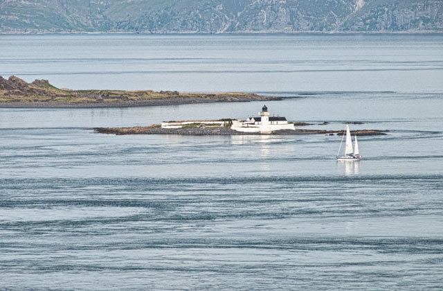
Fladda is an islet in the Sound of Luing, between Luing and Belnahua. The name Fladda originates from the Old Norse for 'flat island'.
Lighthouse
Fladda lighthouse is an active lighthouse located on the Islet of Fladda, one of the Slate Islands about 1.8 kilometres (1.1 mi) off Cullippol. The lighthouse was built in 1860 on project by David A. and Thomas Stevenson; it is a cylindrical masonry tower 13 metres (43 ft) high with gallery and lantern. The tower is painted white, the lantern is black and has ochre trim; it is a minor light operated by Northern Lighthouse Board but managed privately. The light emits a two white flashes every 9 seconds. The keeper’s house seems to be home to a large colony of terns.