
Admin. region Oberbayern Elevation 771 m (2,530 ft) Population 5,469 (31 Dec 2008) | Time zone CET/CEST (UTC+1/+2) Local time Sunday 3:37 PM | |
 | ||
Weather 8°C, Wind NE at 16 km/h, 36% Humidity Points of interest Breitenstein, Aiplspitz, Skilift Raffelmoos | ||
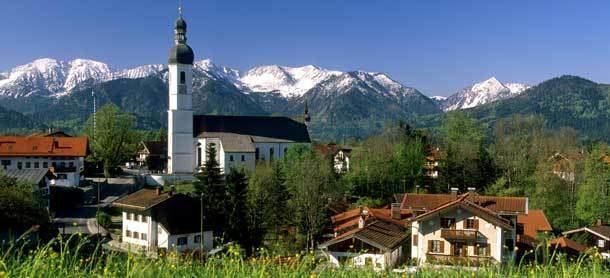
Fischbachau is a municipality in the district of Miesbach in Bavaria in Germany.
Contents
Map of 83730 Fischbachau, Germany
Geography
Fischbachau is located in the valley of the river Leitzach, on an Alluvial fan at the east edge of the Leitzachtals and at the foot of Breitenstein mountain. The town is located 9 miles away from Miesbach, 15 miles from Rosenheim, 19 miles from Kufstein and 37 miles from Munich, capital city of Bavaria.
History
Fischbachau is mentioned for the first time in the Frisian Liber commutationum et traditionum around 1078-1080. From 1096 to 1100 the St. Martin abbey was constructed and in 1803 the Scheyern Abbey. In 1811 Fischbachau was turned into a formal municipality with a mayor. During World War II, a subcamp of the Dachau concentration camp was located here. In 1976 Hundham, Wörnsmühl and in 1978 southern parts of a territory of the former municipality of Niklasreuth were merged into the Municipality of Fischbachau.