
Population 770 (2011) Sovereign state United Kingdom Local time Saturday 11:25 PM | OS grid reference TM029203 Post town Colchester Dialling code 01206 | |
 | ||
Weather 6°C, Wind SE at 8 km/h, 99% Humidity | ||
Fingringhoe is a village and civil parish in Essex, England located five miles south-east of Colchester. The centre of the village is classified as a conservation area featuring a traditional village pond and red telephone box. The Roman River flows nearby before entering the River Colne. It has frequently been noted on lists of unusual place names.
Contents
- Map of Fingringhoe Colchester UK
- Fingringhoe Wick
- Roman Port
- Middle Ages
- Trivia
- St Andrews Church
- References
Map of Fingringhoe, Colchester, UK
Fingringhoe Wick
Fingringhoe is locally known for its salt marshes, which provide habitats for many birds and salt-water animals. These form part of the Fingringhoe Wick Nature Reserve managed by Essex Wildlife Trust.
Roman Port
During the 1st Century AD Fingringhoe was home to a river port which serviced the nearby provincial capital of Roman Britain at Camulodunum (modern Colchester).
Middle Ages
A manor located at Fingringhoe was donated by Henry I of England to the Norman abbey of Saint-Ouen at Rouen.
Trivia
Fingringhoe is mentioned in Lemon Jelly's "Ramblin' Man" and is in the top 20 list of "rude names" from the book Rude Britain.
Fingringhoe is one of many British towns and villages referenced in Karl Marx's Das Kapital as part of "Illustrations of the General Law of Capitalist Accumulation".
In 2009, an unexploded World War Two bomb was disarmed in the village.
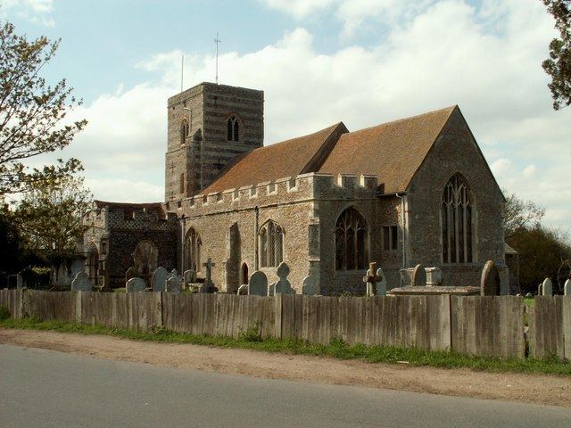
St. Andrew's Church
A prominent feature in the centre of the village, the north wall of St. Andrew's Church dates back to the 12th century.