
OS grid reference NO140662 Sovereign state United Kingdom Postcode district PH10 Local time Saturday 10:41 PM | Post town BLAIRGOWRIE Dialling code 01250 | |
 | ||
Weather 4°C, Wind S at 16 km/h, 98% Humidity UK parliament constituency | ||
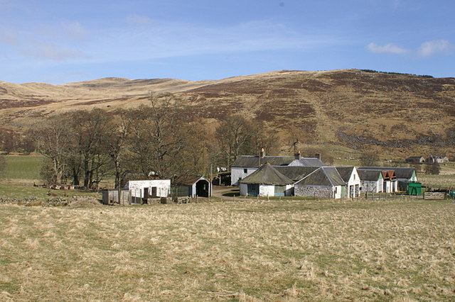
Finegand is a farming hamlet located in eastern Perth and Kinross, Scotland and also refers historically to the portion of lands surrounding the hamlet. Finegand is located in Glen Shee and encompasses the lands east of the Shee Water adjacent to a burn which joins it about 4 miles below the Spittal and about 18 miles north of Blairgowrie.
Map of Finegand, Blairgowrie, UK
The name is a corruption of the Gaelic Fèith nan Ceann, meaning "the burn of the heads" and takes its name from an event, which according to legend, took place sometime in the 15th century. Local history tells of 15th century tax collectors sent repeatedly to Glenshee, probably by the oppressive Earl of Atholl, to collect ever-increasing tax from the highlanders "in whatever manner they deemed most effective", usually at the point of a sword. On one occasion, the glensmen having become so enraged at the tax collectors' pillaging, not only killed them all, but cut off their heads and threw them into the burn.
Finegand and the surrounding lands were long associated with the Clan MacThomas although few clansmen remain in the glen, having fled or been forcibly disbursed after supporting the Jacobite cause.