
Country United States Incorporated 1980 Elevation 269 m Local time Thursday 2:04 PM | Settled 1787 Population 21,390 (2013) | |
 | ||
Weather 21°C, Wind SW at 14 km/h, 23% Humidity Neighborhoods Concord Farragut, Woodchase, Woodland Trace | ||
Farragut is a town which straddles both Knox and Loudon counties in Tennessee. It is a suburb of Knoxville. The town's population was 20,676 at the 2010 census. It is included in the Knoxville Metropolitan Area. The town is named in honor of American Civil War Admiral David Farragut, who was born just east of Farragut at Campbell's Station in 1801.
Contents
- Map of Farragut TN USA
- History
- Geography
- Demographics
- Historic buildings
- Education
- Notable people
- Media
- References
Map of Farragut, TN, USA
History
The area was originally known as Campbell’s Station after a fort and stage coach station erected by Captain David Campbell (1753–1832) in 1787. The brick Campbell's Station Inn was built in 1810 and still stands on Kingston Pike within sight of the Farragut Town Hall. It is still in use as a private residence. The Civil War Battle of Campbell's Station was fought there on November 16, 1863.
The historic unincorporated village of Concord (listed on the National Register of Historic Places) was founded in 1854 just east of what would become the eastern boundary of Farragut. Concord is located on the main rail line to Atlanta and main channel of the Tennessee River, and was an important transloading center for the Tennessee marble industry in the late 19th century. Picturesque buildings and antebellum homes sit along the river, as well as several very old churches.
The original Farragut High School was built by the community in 1904, and moved to its current location in 1976. Some parts of Farragut are zoned for Hardin Valley Academy, built in 2008.
On January 16, 1980, Farragut incorporated as a town, mainly to avoid being annexed by Knoxville, which was trying to shore up its tax base by annexing affluent communities along Kingston Pike. The first mayor, Bob Leonard, was elected April 1, 1980, along with four aldermen. Alderman Eddy Ford became mayor in 1993 and served in that position until April 2009, when he failed to win re-election, losing to Dr. Ralph McGill, another of the original founders of the town government.
Geography
Farragut is located at 35°52′39″N 84°10′25″W (35.877511, -84.173548). According to the United States Census Bureau, the town has a total area of 16.2 square miles (42.1 km²), of which 16.1 square miles (41.7 km²) is land and 0.2 square mile (0.4 km²) (1.05%) is water.
Farragut is situated in a hilly area between Blackoak Ridge to the north and the Tennessee River (Fort Loudoun Lake) to the south. Its municipal area is mostly located south of the merged Interstate 40/Interstate 75, with the exception of a few neighborhoods. Kingston Pike, a merged stretch of U.S. Route 70 and U.S. Route 11, traverses the town. Farragut borders Knoxville on the northeast, and the Knox County-Loudon County line forms most of its southwestern boundary. Concord lies immediately southeast of Farragut, and Hardin Valley lies opposite Blackoak Ridge to the north. The small community of Dixie Lee Junction lies along Kingston Pike, just across the Loudon County line.
Demographics
As of the census of 2000, there were 17,720 people, 6,333 households, and 5,231 families residing in the town. The population density was 1,101.5 people per square mile (425.2/km²). There were 6,628 housing units at an average density of 412.0 per square mile (159.0/km²). The racial makeup of the town was 93.88% White, 1.80% African American, 0.15% Native American, 3.16% Asian, 0.33% from other races, and 0.69% from two or more races. Hispanic or Latino of any race were 1.07% of the population.
There were 6,333 households out of which 39.4% had children under the age of 18 living with them, 76.0% were married couples living together, 5.0% had a female householder with no husband present, and 17.4% were non-families. 15.2% of all households were made up of individuals and 5.5% had someone living alone who was 65 years of age or older. The average household size was 2.76 and the average family size was 3.08.
In the town, the population was spread out with 26.7% under the age of 18, 5.3% from 18 to 24, 24.4% from 25 to 44, 32.2% from 45 to 64, and 11.4% who were 65 years of age or older. The median age was 42 years. For every 100 females there were 97.8 males. For every 100 females age 18 and over, there were 94.4 males.
The median income for a household in the town was $82,726, and the median income for a family was $91,423. Males had a median income of $70,873 versus $34,955 for females. The per capita income for the town was $35,830. About 2.6% of families and 2.9% of the population were below the poverty line, including 2.9% of those under age 18 and 4.1% of those age 65 or over.
According to the 2007 official Census Bureau estimates, median household income and median family income had risen to $94,420 and $108,236 respectively.
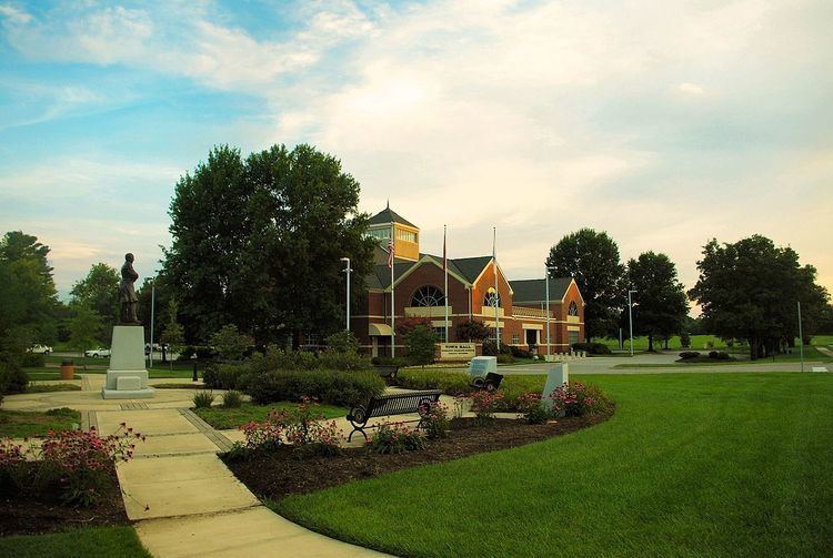
Historic buildings
Education
These schools are a part of Knox County Schools. (Although the school is not in the town limits, Hardin Valley Academy serves parts of Farragut)