
- summer (DST) CDT (UTC-5) Area code 309 Postal code 61842 | Population 2,025 (2013) Local time Thursday 11:03 AM | |
 | ||
Weather 11°C, Wind E at 23 km/h, 37% Humidity Area 6.345 km² (6.216 km² Land / 13 ha Water) | ||
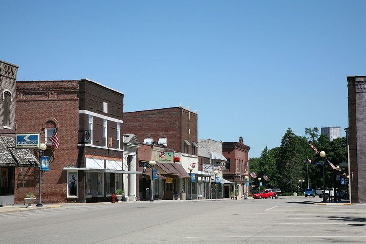
Farmer City is a city in DeWitt County, Illinois, United States. The population was 2,037 at the 2010 census.
Contents
- Map of Farmer City IL 61842 USA
- History
- Geography
- Demographics
- Transportation
- Media
- Notable people
- References
Map of Farmer City, IL 61842, USA
Farmer City is part of Blue Ridge Community Unit School District 18 sharing facilities with nearby Mansfield and Bellflower, Illinois. Farmer City facilities include the District Unit Office, the Ruth M. Schneider Elementary School (K-3) and Blue Ridge High School. Blue Ridge received a bronze in the U.S. News and World Report Best High Schools list.
History
The Kickapoo and Potawatomi Native American tribes lived on the prairie and woodlands around Salt Creek and other local streams. The westwards push of traders and adventurers led to settlers around 1825. Dennis Hurley is believed to be the first white settler in the area; build a cabin, the area became known as Hurley's Grove with other families settling the area. Founding families were the Kirbys, McCords, Clearwaters, Watsons, Johnson, Webb, Blalach, Weedmans, Coveys, Cummings and Huddlestons. Hurley's Grove was just south of present-day Farmer City, with increased population by 1837, becoming part of DeWitt County in 1839.
The area to the south of Hurley's Grove solidified as a permanent settlement, within the wooded areas safety. North of the primary area became known as Mt. Pleasant. Subdivision of the land divided the area into 14 blocks, with a central public square; the first residence built was that of Nathan Clearwater, and William McFall opened a store in 1837. Mail delivery was established in 1837, but with another Mt. Pleasant in the state, the name changed to Santa Anna.
Dewitt County was part of the Eighth Judicial District in the early 1850s, and lawyer Abraham Lincoln traveled in the area many times on his circuit; he was well respected by county residents. C. H. Moore House in nearby Clinton is the former residence of Lincoln's co-counsel in various cases.
The settlement grew in population and physical size, with the center of activity moving northward. The area became connected in 1870 by rail, prospering; that year's census listed 1276 people in the township, and 537 in Mt. Pleasant. The necessity of an official name arose in 1869, with Farmer City chosen after much discussion and debate. The business district was destroyed in 1879 by a major fire, but the town was rebuilt. The rebuilding process had to be rebooted after an 1894 fire destroyed the new business district.
The early years of the next century saw Farmer City grow into a bustling community. A newspaper, the Public Reaper, first printed on November 27, 1879. City fathers helped usher the area into a modern era, with utilities such as a water tower (1920). The new business district was joined by schools, churches, and fine homes. Interstate 74 was completed in the early 1970s. In 1980, an extensive study of the dialect of Farmer City was completed, making the city well known in the field of sociolinguistics.
Geography
Farmer City is located at 40°14′47″N 88°38′31″W (40.246306, -88.641858).
According to the 2010 census, Farmer City has a total area of 2.449 square miles (6.34 km2), of which 2.4 square miles (6.22 km2) (or 98%) is land and 0.049 square miles (0.13 km2) (or 2%) is water.
Farmer City, Illinois is the only Farmer City in the entire United States.
Demographics
As of the census of 2000, there were 2,055 people, 830 households, and 557 families residing in the city. The population density was 892.8 people per square mile (345.0/km²). There were 906 housing units at an average density of 393.6 per square mile (152.1/km²). The racial makeup of the city was 99.56% White, 0.05% from other races, and 0.39% from two or more races. Hispanic or Latino of any race were 0.39% of the population.
There were 830 households out of which 32.2% had children under the age of 18 living with them, 52.8% were married couples living together, 9.8% had a female householder with no husband present, and 32.8% were non-families. 28.1% of all households were made up of individuals and 14.7% had someone living alone who was 65 years of age or older. The average household size was 2.41 and the average family size was 2.94.
In the city, the population was spread out with 24.7% under the age of 18, 7.0% from 18 to 24, 27.6% from 25 to 44, 21.6% from 45 to 64, and 19.1% who were 65 years of age or older. The median age was 39 years. For every 100 females there were 93.5 males. For every 100 females age 18 and over, there were 90.0 males.
The median income for a household in the city was $40,223, and the median income for a family was $45,515. Males had a median income of $34,524 versus $22,438 for females. The per capita income for the city was $19,946. About 5.6% of families and 8.3% of the population were below the poverty line, including 15.4% of those under age 18 and 3.3% of those age 65 or over.
Transportation
Interstate 74, which is paralleled by US 150, and State Route 54 intersect near Farmer City. They are paralleled by routes of the Norfolk Southern Railway and Illinois Central Railroad, respectively.
Media
Farmer City is the home of WWHP, an FM radio station broadcasting on a frequency of 98.3 mHz. Its programming consists of classic rock, whose broadcasts can also be heard online.