
Counties: Fort Bend Constructed 2 May 1962 | Length 14.9 km County Fort Bend County, Texas | |
 | ||
Existed: May 2, 1962 (1962-05-02) – present North end: I-69 / US 59 / SH 99 near Greatwood South end: Thompsons Old Field Road in Thompsons | ||
Farm to Market Road 2759 (FM 2759) is a state highway in the U.S. state of Texas that stays within Fort Bend County. The highway begins at Interstate 69 (I-69)/U.S. Highway 59 (US 59), heads southwest to Farm to Market Road 762, turns southeast and ends in Thompsons.
Contents
- Map of Farm To Market 2759 Richmond TX 77469 USA
- Route description
- History
- Major intersections
- References
Map of Farm-To-Market 2759, Richmond, TX 77469, USA
Route description
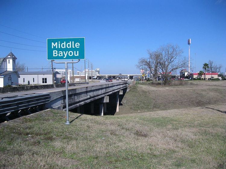
FM 2759 starts as a four-lane road at a I-69/US 59 underpass and goes southwest for 1.8 miles (2.9 km). In this stretch, FM 2759 is also known as Crabb River Road. The highway is a continuation of State Highway 99 (SH 99) which heads northeast from I-69/US 59. Nearby communities include Greatwood, Tara and Canyongate at the Brazos. Businesses along Crabb River Road include a car dealership, a few filling stations, and a number of stores and restaurants. There are traffic signals at Sansbury Boulevard and Tara Drive and bridges over Middle Bayou and Rabbs Bayou. FM 2759 turns sharply to the east-southeast at the traffic light controlled intersection with FM 762.
From this place to its terminus, FM 2759 runs parallel to the BNSF Railway tracks. For 1.0 mile (1.6 km) until it reaches Macek Road, the highway passes along the south side of the Tara subdivision. The William C. Velasquez Elementary School of the Lamar Consolidated Independent School District is 500 yards (457 m) north of the highway at Macek Road. After this point the landscape becomes rural. At Booth, the highway bends more to the southeast. The Riverpointe Golf Club is southeast of Booth on the north side. Just before Pittman Road, FM 2759 passes under electric transmission lines before curving slightly more to the southeast. As the highway approaches Thompsons, there is an oil well, tanks and a flare on the north side. Near Y. U. Jones Road, the highway bends so that it goes nearly east. After an additional 0.5 miles (0.8 km) FM 2759 intersects with Thompsons Oil Field Road, which goes south across the railroad tracks. The road continues east for another 0.5 miles (0.8 km) but only connects with minor roads beyond that point.
History
FM 2759 was originally designated on May 2, 1962, to go from FM 762 at Crabb to the southeast about 7.4 miles (11.9 km) to Thompsons. On September 5, 1973, the highway was extended an additional 1.7 miles (2.7 km) to the northeast from FM 762 to what is now I-69/US 59.
Major intersections
The entire highway is in Fort Bend County.