
South end: SH 36 at Pleak Counties: Fort Bend Constructed 24 March 1954 | North end: FM 1640 in Richmond Length 9.104 km County Fort Bend County, Texas | |
 | ||
Existed: March 24, 1954 (1954-03-24) – present | ||
Farm to Market Road 2218 (FM 2218) is a state highway in the U.S. state of Texas that stays within Fort Bend County. The highway begins at State Highway 36 (SH 36) in Pleak, heads northeast through Rosenberg and ends at Farm to Market Road 1640 (FM 1640) in Richmond.
Contents
Map of Farm-To-Market Rd 2218, Texas, USA
Route description
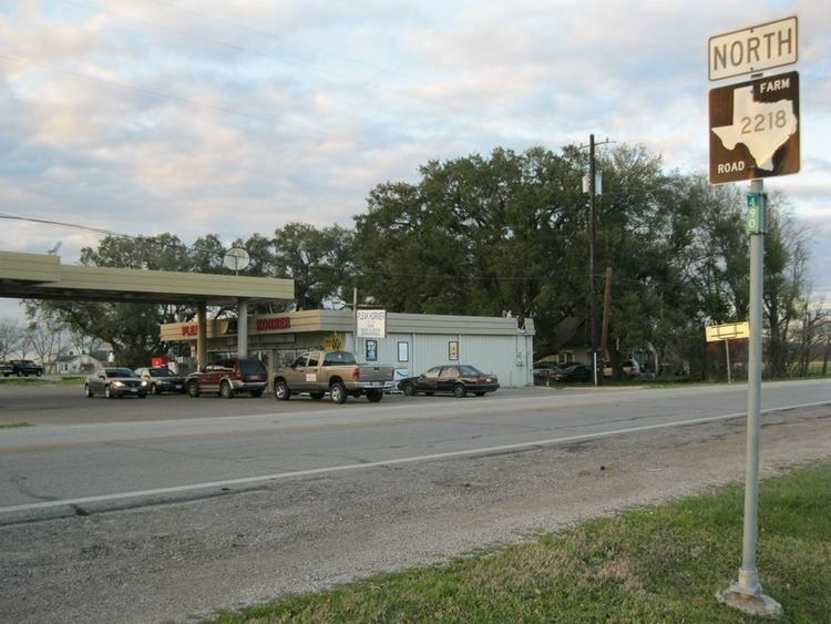
FM 2218 begins at a traffic signal on SH 36 in Pleak. There is a filling station on the northeast corner and the Pleak City Hall is nearby. The highway immediately heads northeast. On the outskirts of Pleak, FM 2218 curves north, then it turns north-northeast near the Meadow Bend Park Estates subdivision. Near Lane Airpark, the highway veers northeast again. At a distance 3.8 miles (6.1 km) from its starting point, the highway comes to the Interstate 69 (I-69)/U.S. Route 59 (US 59) overpass. FM 2218 continues northeast from I-69/US 59 through Rosenberg, with traffic lights at Airport Avenue, Avenue N, Reading Road and Town Center Boulevard. This stretch of the highway is also known as B. F. Terry Boulevard. B. F. Terry High School in the Lamar Consolidated Independent School District is situated on the northwest side of FM 2218 between Airport and Avenue N. The highway ends at a traffic signal on FM 1640. There is a Walmart on the south side and a Wharton County Junior College campus on the north side.
History
FM 2218 was first designated on March 24, 1954, to run from FM 1640 at Richmond to SH 36 at Pleak. Since its original authorization there has been no change to the route.
Major intersections
The entire highway is in Fort Bend County.