- location Diana - average 4.5 m/s (159 cu ft/s) | - elevation 1,815 m (5,955 ft) - elevation 0 m (0 ft) Basin area 1,827 km² | |
 | ||
- max 70.5 m/s (2,490 cu ft/s) Similar Namorona River, Mandrare River, Sambirano River | ||
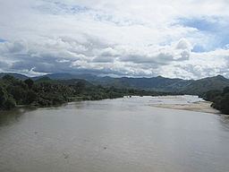
The Fanambana River is located in northern Madagascar and crosses the Route Nationale 5a near Morafeno. Its sources are situated in the Marojejy Massif and flows into the Indian Ocean south of Vohemar.
Map of Fanambana, Madagascar
References
Fanambana River Wikipedia(Text) CC BY-SA
