Neha Patil (Editor)

False Bay (Livingston Island)

Updated on
Edit
Like
Comment
Share on FacebookTweet on TwitterShare on LinkedInShare on Reddit
False Bay (Livingston Island)

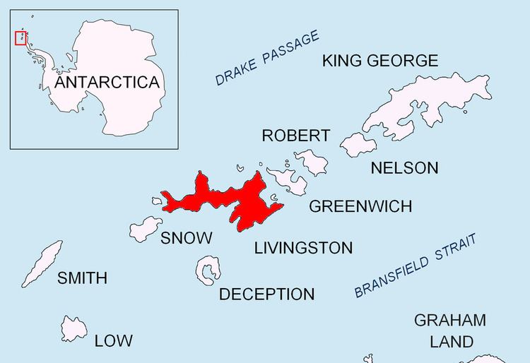
False Bay (62°43′S 60°22′W) is a bay 4 miles (6.4 km) long, which lies between Barnard Point and Miers Bluff on the south side of Livingston Island, in the South Shetland Islands, Antarctica. The glaciers Hurd Ice Cap, Huntress, Ruen Icefall, Peshtera and Charity feed the bay.

It was probably first entered and charted by Captain Nathaniel Palmer in November 1820, and was likely named because of the possibility in thick weather of confusion between this feature and nearby South Bay, where Johnsons Dock was frequented by the early sealers.

Maps

  • South Shetland Islands. Scale 1:200000 topographic map No. 5657. DOS 610 – W 62 60. Tolworth, UK, 1968.
  • Islas Livingston y Decepción. Mapa topográfico a escala 1:100000. Madrid: Servicio Geográfico del Ejército, 1991.
  • L.L. Ivanov. Antarctica: Livingston Island and Greenwich, Robert, Snow and Smith Islands. Scale 1:120000 topographic map. Troyan: Manfred Wörner Foundation, 2009.
  • Antarctic Digital Database (ADD). Scale 1:250000 topographic map of Antarctica. Scientific Committee on Antarctic Research (SCAR), 1993–2016.
  • References

    False Bay (Livingston Island) Wikipedia