
Major cities Belfast | Province Ulster | |
 | ||
Location Belfast, Northern Ireland | ||
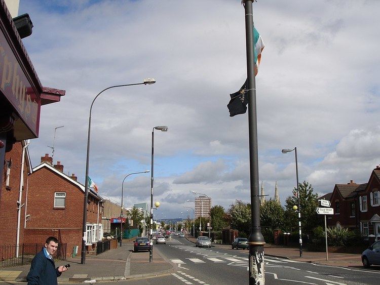
The Falls Road (from Irish túath na bhFál, meaning 'territory of the enclosures') is the main road through west Belfast, Northern Ireland, running from Divis Street in Belfast city centre to Andersonstown in the suburbs. Its name is synonymous with the republican community in the city, whilst the neighbouring Shankill Road is predominantly loyalist, separated from the Falls Road by peace lines. The road is usually referred to as the Falls Road, rather than as Falls Road. It is known as the Faas Raa in Ulster-Scots.
Contents
- Map of Falls Rd Belfast BT12 4PY UK
- History
- Politics
- Culture
- Education
- Churches
- Parks and Cemeteries
- Buildings
- References
Map of Falls Rd, Belfast BT12 4PY, UK
History
The Falls Road derives its name from the Irish túath na bhFál, an Irish petty-kingdom whose name means "territory of the enclosures". This territory was roughly the same as that of the ecclesiastical parish of the Shankill, which spanned a large portion of modern-day Belfast.
The Falls Road itself was originally a country lane leading from the city centre but the population of the area expanded rapidly in the 19th century with the construction of several large linen mills. All of these have now closed or have been repurposed. This original area, which was centred on the junction of modern-day Millfield and Hamill Street on what is now Divis Street, was known as Falls and lent its name to the road, which had previously been called "the Pound". The housing in the area developed in the 19th century and was organised in narrow streets of small terraced housing. Many of these streets were named after characters and events in the Crimean War (1853–1856) which was occurring at that time.
These included Raglan Street (named after Lord Raglan, commander of British forces in the Crimean War), Alma Street (named after the Battle of Alma), Balaklava Street (named after the Battle of Balaklava), Inkerman Street (named after the Battle of Inkerman), and Sevastopol Street (named after the Siege of Sevastopol).
By the 1960s the buildings in the area had decayed considerably and the Belfast Corporation introduced a major development plan which involved wholescale demolition of much of the area and its replacement with a series of flat complexes. The high point of this redevelopment was Divis Tower, built on top of the historic district formerly known as the Pound Loney.
Politics
A predominantly working class community, the Falls Road has historically had a strong socialist tradition and prior to the 1970s had also been less Irish nationalist than other areas of Northern Ireland. James Connolly resided in the Upper Falls for a period in the early 20th century and was involved in organising the workers but the area was generally seen as a bedrock of the Irish Parliamentary Party (IPP) at the time. Éamon de Valera lost heavily here in the 1918 UK General Election to the IPP's Joe Devlin. Connolly's secretary Winifred Carney also lived on the Falls with her husband, George McBride, a Protestant and World War I veteran. The past century has seen an ongoing contest between various versions of labour/socialist and nationalist/Irish republican for electoral leadership in the area. In the 1929 election to the new Parliament of Northern Ireland, the Belfast, Falls constituency was won by the Nationalist Richard Byrne after a bitter contest with William McMullen, a supporter of Connolly.
In the 1945 election, Harry Diamond won the seat standing for the Socialist Republican Party. He held the seat until 1969, when he was defeated by Paddy Devlin standing for the Northern Ireland Labour Party. Devlin, who had once been a member, alongside Diamond, of the Belfast branch of the Irish Labour Party, became a founding member of the Social Democratic and Labour Party in 1970 and remained a member until Parliament was prorogued in 1972.
In 1964, Billy McMillen stood as a Republican Clubs candidate for the Belfast West constituency in the Westminster election. His office was in Divis Street and the Irish tricolour alongside the Starry Plough of Connolly's Irish Citizen Army was displayed in the window. The public display of the flag of the Republic of Ireland was banned by the Northern Ireland Government. Protestant preacher Ian Paisley insisted the Royal Ulster Constabulary remove the flag or he would organise a march and remove it himself. The police feared a backlash from Loyalists, and removed it, causing unrest and rioting by nationalists.
In the late 1960s, many Catholics from across Northern Ireland began to campaign, many with NICRA, against discrimination in housing and jobs, under the banner of a civil rights campaign, in conscious imitation of the philosophy of, and tactics used by, the American Civil Rights Movement.
Many unionists saw NICRA as an Irish republican Trojan horse, designed to destabilize Northern Ireland, and force unionists into a united Ireland. Several streets around the Falls Road were burnt out by loyalists in August 1969. In response to the worsening situation, the British Government deployed the British Army on the Falls Road. The troops were initially welcomed by many but not all Falls residents to protect them, but heavy handed tactics by the mostly mainland British-born members of the Army who did not know or understand the situation would estrange most Catholics and nationalists.
In 1970, the road was the scene of what became known as the Falls Curfew. 3,000 British troops sealed off the streets around the Falls road, home to about 10,000 people, setting off CS gas. The British actions were opposed by the Official IRA (OIRA), who engaged them in a vicious gun battle. Over the course of the weekend, four Catholic civilians were killed by the British Army. Ninety rifles were recovered. This is widely regarded as the end of the British Army's "honeymoon" period with nationalists in Belfast.
For the following three decades, the British Army maintained a substantial presence on the Falls Road, with a base on top of the Divis Tower. This was removed in August 2005 as part of the British government's normalisation programme, following the Provisional Irish Republican Army's statement that it was ending its armed activities. In the intervening period, the Falls Road area saw some of the worst violence of "the Troubles". The last British soldier to be killed on the road itself was private Nicholas Peacock, killed by a booby trap bomb left outside the Rock Bar, opposite the top of the Donegall Road.
In 1991 IRA hit squads based in the Upper Falls and Beechmount were involved in attacks against loyalist paramiliaries in the nearby Village area. In September 1991, they shot dead 19 year old UVF member John Hanna at his home on the Donegall Road, and in November the same year, they shot dead William Kingsberry and his stepson Samuel Mehaffey, members of the UDA and RHC respectively, in their home on Lecale Street.
Culture
Since the 1960s there has been a substantial revival of traditional culture in terms of Irish language, dancing and music. These are all showcased during the Féile an Phobail, an annual festival of Irish culture. Cultúrlann McAdam Ó Fiaich, known colloquially as the Cultúrlann, is an Irish language and arts centre based on Falls Road. The centre also houses Irish language bookshop An Ceathrú Póilí. One of three Carnegie libraries built in Belfast is situated on Falls Road. It opened on 1 January 1908 and is the last Carnegie library in Belfast still functioning as a library.
Education
There are number of educational institutions in the immediate area. St Finian's and St Catherine's primary schools were closed due to falling student numbers. St. Catherine's merged with St John's Girls and St Gall's Boys to form St Clare's in September 2005.
At the senior level there are three schools for girls. These are St Dominic's Grammar School for Girls, St Rose's High School, and St. Louise's Comprehensive College, which is one of the largest comprehensive girls schools in Europe. Senior schools for boys include St. Mary's Christian Brothers' Grammar School. This school was originally located in Barrack Street off Divis Street in the lower Falls Road area but transferred to a greenfield site on the Glen Road in the upper Falls area in the 1960s. There is also an Irish language secondary school Coláiste Feirste. At the higher education level there is St Mary's University College which is part of Queen's University Belfast.
The Dunlewey Centre is a community education centre in the heart of the lower Falls Road.
Churches
There are several Roman Catholic churches in the Falls Road area. These include St Peter's Cathedral in the Lower Falls area just off Albert Street. This church opened in 1866 on land donated by the famous Belfast baker, Barney Hughes. St Paul's Church is in the mid-Falls area. Nearby is located Clonard monastery, the home of the Redemptorist religious order. Father Alec Reid who played an important role in the Northern Ireland peace process was based here. St John's Church is located in the Upper Falls area
There used to be several Protestant churches located on or near the Falls Road but these have either been demolished or converted into other uses as their congregations dwindled. These churches included the Methodist church in Divis Street (1850-1966) which was designed by Charles Lanyon. There was also a Presbyterian church in Albert Street (1852-1972) where one of the ministers was the Rev. Henry Montgomery who helped establish the Shankill Road Mission in 1896, and another Presbyterian church in the mid-Falls area. That church has been converted into the Culturlann - an Irish language cultural centre.
Parks and Cemeteries
In the Lower Falls area is located Dunville Park, which was first opened in 1893 and has recently been refurbished and includes football pitches. In the Upper Falls area is located the Falls Park which was established in 1873. This park contains a wide range of sporting facilities.
In the Upper Falls area are located two large cemeteries. The first is Belfast City Cemetery which is located at the junction of the Falls Road and Whiterock Road. This is a municipal cemetery maintained by the Belfast City Council. At the junction of the Falls Road and the Glen Road is located the Catholic Church-run Milltown Cemetery, synonymous with Irish republicanism.
Buildings
There are several large hospitals in the area including the Royal Victoria Hospital, the Royal Jubilee Maternity Service, the Royal Belfast Hospital for Sick Children, and the Royal Dental Hospital
The Lower Falls area previously had many linen mills. These have either been demolished or converted for other purposes. One of these is Conway Mill, in Conway Street (named after the Conway family, a noted generous family of the Clonard Area). Originally a flax spinning mill, it now houses a community enterprise of small businesses, art studios, retail space and education floor.