
Local time Sunday 8:30 AM | ||
 | ||
Weather 23°C, Wind N at 14 km/h, 46% Humidity Civil parish Nossa Senhora do Monte, Cape Verde | ||
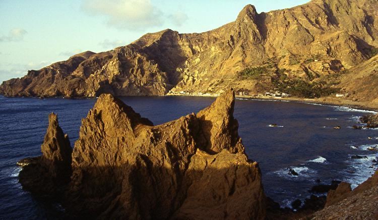
Fajã de Agua is a village on the northwestern coast of the island of Brava, Cape Verde. It is 4 km west of the island capital Nova Sintra. Fishing and agriculture (maize, beans, bananas and papayas) are the most important sources of income.
Contents
Map of Faj%C3%A3 de Agua, Cape Verde
History
In the 18th and 19th century, whaling was an important source of income for Brava. Many whaling ships from America landed in Fajã de Água. Fajã de Água used to be the most important harbour of Brava until 1843 when the present harbour of Furna was founded. A small airport named Esperadinha with a paved runway was inaugurated in Fajã de Água in 1992. It connected Brava with the nearby islands of Fogo and Santiago, but was closed in 2004 because of frequent strong winds which make landing impossible.
Sights
There is a beautiful walking track to the pilgrimage church of Nossa Senhora do Monte in the middle of the island. There is a natural swimming pool in the South of Fajã de Água about one kilometer from the village. If the wind is not too strong and the waves are not too high, swimming is possible here. Further to the South there is the dark sandy beach Porto do Portete which is not easily accessible.
Opposite the small church at the Northern end of Main Street there is a sightworthy monument (Monumento aos Emigrantes) which was erected in 1993. It reminds on the sailing ship Matilde which left Fajã de Água for America on 21 August 1943. It was lost in the Atlantic Ocean and 51 persons lost their lives. Nearly every family in Fajã de Água lost one or more relatives.