
PIN 425503 Elevation 226 m Local time Sunday 2:47 PM | Time zone IST (UTC+5:30) Telephone code 02585 Population 50,000 (2011) Area code 02585 | |
 | ||
Weather 32°C, Wind N at 5 km/h, 10% Humidity Neighborhoods Shriram Peth, Ganesh Colony, Ganpati Wadi, Dhobi wada, Shiv Colony, Hajira Mohalla, Taha Nagar | ||
Faizpur is a city and a municipal council in Jalgaon district in the state of Maharashtra, India.It belongs to Yawal taluka.
Contents
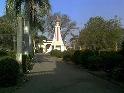
Map of Faizpur, Maharashtra
Food = Famous for Vangaya (Brinjal) ch Bharat, Thecha,Chutney and Kalna (Udad and Jowar mix atta).Also Shev Bahji The popular and commonly wedding food is Vangaya chi Bhaji and Rodaga (made of wheat which is roasted in cowdung cakes ). Dhanaji sheth Aloo Vada, Misal Pav,and Shevs are very popular. Its also sent in foreign countries.
Geography
Faizpur is located at 21.17°N 75.85°E / 21.17; 75.85. It has an average elevation of 226 metres (741 feet).
History
The first rural (and 51th national) conference of Indian National Congress was held in Faizpur in 1937 in presence of Mahatma Gandhi, Pandit Nehru was President and Rajmal Lalwani was the treasurer for that conference. President list - PK Chaudhari 5 year, Nilesh Rane 3 year , Dr.Asaram Bharambe(Sir)13 year, BK Chaudhari 2 Year,Wagulde 5 year, Choldas Bomatu Patil 5 year.
Near tourist Spot
Pal (35Km)
श्रीमनुदेवी(30Km)
Demographics
As of 2011 India census, Faizpur had a population of 96,724. Males constitute 52% of the population and females 48%. Faizpur has an average literacy rate of 76%, higher than the national average of 59.5%: male literacy is 80%, and female literacy is 68%. In Faizpur, 13% of the population is under 6 years of age.