
Time zone WAT (UTC+1) Local time Sunday 1:55 AM | Commune Fachi Elevation 594 m | |
 | ||
Weather 14°C, Wind N at 10 km/h, 18% Humidity | ||
Salt caravan coming from agadez to fachi tenere niger
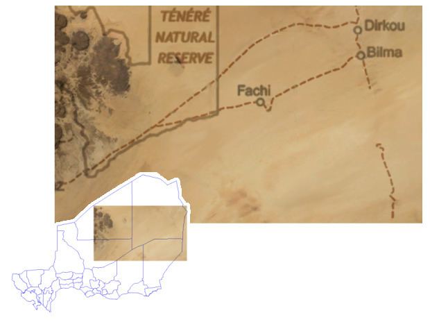
Fachi is an oasis surrounded by the Ténéré desert and the dunes of the Erg of Bilma in eastern Niger, placed on the western edge of the small Agram mountain outcropping. It has an estimated population of some 2000 people. A stopping point of the Agadez to Kaouar caravans of the Azalay, Fachi is 240 kilometres (150 miles) west of Bilma and 320 km (200 mi) east of the Aïr Mountains. Apart from water, dates, and salt, Fachi produces no provisions, and depends entirely upon trade in these products with passing caravans.
Contents
Map of Fachi, Republic of Niger
Frequently raided by Tuareg and other Bedouins in its past, the town is built within high fortifications, known locally as a ksar, built from banco salt blocks. They are now disused.
Fachis population is largely drawn from the Kanuri and Toubou peoples, in whose language the town is called Agram. Fachi, its official name, is from Tuareg and Hausa peoples who at one time lived there in larger numbers.