
 | ||
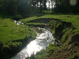
The Eyserbeek (Limburgish: Ezerbaek) is a river in the province of Limburg, Netherlands. The Eyserbeek is a right-bank tributary to the river Geul, which later joins the Meuse. Rising in Bocholtz and flowing through Simpelveld and Eys, the Eyserbeek eventually drains in the river Geul in Gulpen. The Eyserbeek lies on the north of the plateau of Bocholtz and south of the plateau of Ubachsberg.
Map of Eyserbeek, Netherlands
Sources of the Eyserbeek can be found in Bocholtz near Hoeve Overhuizen, from where it passes the N281 provincial road, before flowing through the town square of Simpelveld. In 2012 Simpelveld reorganised its town square, which used to cover the river, opening the river to view and creating a new riverbank with bluestone. The Eyserbeek then passes the monumental Oude Molen and Bulkemsmolen watermills, build in 1774 and 1753 respectively, before passing into the village of Eys, which was named after the river. The Eyserbeek eventually drains in the river Geul near the former Motte-and-bailey castle Gracht Burggraaf in Gulpen, where also the Gulp River joins the Geul from the opposite bank.