
 | ||
Similar Cape Range National, Ningaloo Coast, Yardie Creek Road, Naval Communication Station H, Vlaming Head Lighthouse | ||
Pearl diving exmouth gulf western australia
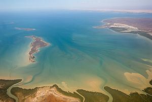
Exmouth Gulf is a gulf in the north-west of Western Australia. It lies between North West Cape and the main coastline of Western Australia. It is considered to be part of the region of the North West Shelf and in the Canning Basin area.
Contents
- Pearl diving exmouth gulf western australia
- Map of Exmouth Gulf Western Australia Australia
- Environment
- Birds
- References
Map of Exmouth Gulf, Western Australia, Australia
Environment
Exmouth Gulf is a rich marine environment. It is a nursery for humpback whales, dugong and turtles. The mangrove systems on the eastern margins are areas of high primary productivity feeding and restocking both the Gulf and the famed nearby Ningaloo Reef.
A proposal for a system of solar salt evaporation ponds stretching more than 30 km along the gulf's south-western coast has given rise to heated debate on possible environmental impacts on the area.
The Gulf and off-shore waters beyond the Ningaloo fringing reef are home to some of Australia's significant sport fish including marlin, Spanish mackerel, and several sub-species of tuna.
The Gulf sustains one of Western Australia's largest prawn fisheries, managed by the Kailis Fishing Group, which operates under license from the Western Australian Government.
Birds
The mangroves along the eastern side of the gulf stretch for nearly 50 km. They have been identified by BirdLife International as a 420 km2 Important Bird Area (IBA) because they support over 1% of the world populations of pied oystercatchers and grey-tailed tattlers, as well as being an important site for the restricted-range dusky gerygone. Another IBA is 11 ha Sunday Island, lying in the north of the Gulf near the Muiron Islands, which is an important nesting site for roseate terns.