
Population 341 (2011 census) Local time Friday 6:15 PM | Postcode(s) 3678 Postal code 3678 | |
 | ||
Location 272 km (169 mi) NE of Melbourne25 km (16 mi) E of Wangaratta27 km (17 mi) NW of Myrtleford Weather 30°C, Wind SW at 16 km/h, 24% Humidity | ||
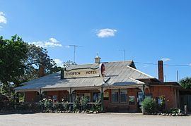
Everton is a small town located 20 kilometres (12 mi) from Wangaratta in northeast Victoria, along the Great Alpine Road. At the 2011 census, Everton and the surrounding area had a population of 341.
Map of Everton VIC 3678, Australia
Attractions of the town and area include the Murray to the Mountains Rail Trail (a sealed off-road bicycle path offering 95 kilometres (59 mi) of cycling along former railway tracks), wineries, and the Victorian High Country.
Everton Post Office opened in 1876 and closed in 1965. An earlier Everton office opened on 8 May 1873, was renamed Everton Station in 1876, Everton Rail around 1909, Everton Upper in 1922 and also closed in 1965.
References
Everton, Victoria Wikipedia(Text) CC BY-SA