Suvarna Garge (Editor)

Eunpyeong District

Updated on
Edit
Like
Comment
Share on FacebookTweet on TwitterShare on LinkedInShare on Reddit
Country
  
South Korea

Special City
  
Seoul

Postal code
  
03300 ~ 03599

Population
  
450,583 (2010)

Region
  
Sudogwon

Administrative dong
  
16

Area
  
29.7 km²

Local time
  
Thursday 1:18 PM

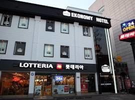
Eunpyeong District secbstaticcomimageshotel270x20026126158074jpg

Time zone
  
Korea Standard Time (UTC+9)

Weather
  
8°C, Wind SW at 23 km/h, 42% Humidity

University
  
Seoul Christian University

EunPyeong District (EunPyeong-gu) is one of the 25 gu which make up the city of Seoul, South Korea.

Contents

Map of Eunpyeong-gu, Seoul, South Korea

The mayor of this district is Kim Uyeong (김우영) since July 2010.

Administrative divisions

  • Bulgwang-dong (불광동, 佛光洞)
  • Daejo-dong (대조동, 大棗洞)
  • Eungam-dong (응암동, 鷹岩洞)
  • Galhyeon-dong (갈현동, 葛峴洞)
  • Gusan-dong (구산동, 龜山洞)
  • Jeungsan-dong (증산동, 繒山洞)
  • Jingwan-dong (진관동, 津寬洞)
  • Nokbeon-dong (녹번동, 碌磻洞)
  • Sinsa-dong (신사동, 新寺洞)
  • Susaek-dong (수색동, 水色洞)
  • Yeokchon-dong (역촌동, 驛村洞)
  • Railways

  • Seoul Metro
  • Seoul Underground Line 3
  • Seoul Metropolitan Rapid Transit Corporation
  • Seoul Underground Line 6
  • Sister cities

  • Canterbury, New South Wales, Australia
  • Dadong, China
  • Yuhong, China
  • References

    Eunpyeong District Wikipedia