
Intercommunality Artois Flandres Area 5.32 km² | Canton Norrent-Fontes Population (1999) 928 Local time Wednesday 10:54 AM | |
 | ||
Weather 10°C, Wind SW at 27 km/h, 97% Humidity | ||
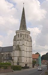
Estrée-Blanche is a commune in the Pas-de-Calais department in the Hauts-de-France region of France.
Contents
Map of 62145 Estr%C3%A9e-Blanche, France
History
Indian Cavalry were stationed at Estrée-Blanche during the First World War
Geography
A farming village some 12 miles (19.3 km) to the northwest of Béthune and 30 miles (48.3 km) west of Lille, at the junction of the D341, D186 and the D159 roads. The small rivers Surgeon and Laquette converge at the commune.
Estrée-Blanche is found at the extreme edge of the coal-mining area of Nord-Pas-de-Calais. Part of its surface area was owned by the mining company, which ceased in the 1960s. All that remains of that era are some typical miners' houses.
It is one of many villages in the north of France bearing the name Estrées. The etymology of the name is from strata (cognate of English "street"), the word for the stone-layered Roman roads in the area (some of which turned into modern highways). Hence Estreti, village on the road which developed into Estrées.