
Area 15.94 km² Local time Tuesday 5:43 PM | Population 5,879 (1 Jan 2006) | |
 | ||
Weather 8°C, Wind W at 21 km/h, 69% Humidity | ||
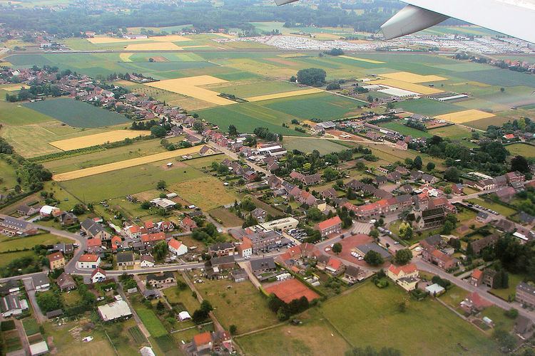
Erps-Kwerps is a village in the Belgian Province of Flemish Brabant and a sub-municipality of Kortenberg. It has an area of 15.94 km^2.
Contents
- Map of Erps Kwerps 3071 Kortenberg Belgium
- Geography
- Location
- Farming in the region
- Parishes
- Transportation
- References
Map of Erps-Kwerps, 3071 Kortenberg, Belgium
Geography
Neighbouring places are Nederokkerzeel (municipality of Kampenhout), Kortenberg, Veltem-Beisem (municipality of Herent), Meerbeek and Everberg.
Location
The village is situated on the prolongation of the runway 07R/25L of the Brussels Airport. Its geographical coordinates are 50° 54' 0" North, 4° 34' 0" East.
Farming in the region
Since it is located within the fertile Central Plateau of the Province of Brabant it is also part of the so-called "Brabantse Groentenstreek", the "Brabant vegetable region". The main cultivation product is Belgian endives.
Parishes
Two parishes exist in Erps-Kwerps, Erps and Kwerps, each having its own church. The church of Erps is named after Saint Amand and the church of Kwerps after Saint Peter. The latter owns a choir of the seventeenth century and a tower of the late Romanesque period. The old town hall at the town square (Dorpsplein) of Erps was built in 1875 after the design of Alexander Van Arenbergh of Leuven.
Transportation
Erps-Kwerps is connected to the railway Brussels - Liège (line 36, HSL 2). The railway station is 2 km from the town centre.