
Country Netherlands Demonym(s) Epenaar, Eper Postcode 8160–8172 Area 157.2 km² Local time Saturday 12:06 PM | Elevation 13 m (43 ft) Time zone CET (UTC+1) Website www.epe.nl Province Gelderland Area code 0578 | |
 | ||
Weather 11°C, Wind SE at 8 km/h, 62% Humidity Points of interest Renderklippen, Veluws Museum Hagedoo, Nederlands Artillerie Museum | ||
Epe ( [ˈeːpə]) is a municipality and a town in the eastern Netherlands.
Contents
Map of Epe, Netherlands
The municipality has a population of 32,191 (2015, source: CBS), and the town itself has a population of 15,552. The town hall stands in Epe, which is situated about 16 km (9.9 mi) north of Apeldoorn and 21 km (13 mi) south of Zwolle.
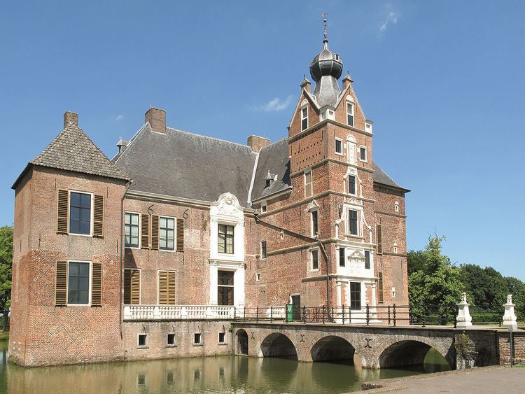
Another important town within the municipality is Vaassen (12,739 inhabitants), halfway between Epe and Apeldoorn. It has an interesting castle called 'Kasteel De Cannenburgh', which is open to visitors (guided tour compulsory). Epe, Vaassen and also the village of Oene each have a beautiful medieval church. Other population centres of interest are Emst, Gortel, Tongeren, Wissel and Zuuk.
Twin towns — sister cities
Epe is twinned with:
Notable residents
References
Epe Wikipedia(Text) CC BY-SA