
 | ||
Um olhar sobre o entre douro e vouga
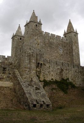
Entre Douro e Vouga ([ˌẽtɾɨ ˌdoɾu ɨ ˈvoɡɐ]) was a former NUTS3 Portuguese subregion. NUT3 regions in Portugal have recently been rearranged and it is now part of Area Metropolitana do Porto - NUT3, integrated in the NUTS2 Norte Region. Its name stood for the fact that it covered an area between the Douro River and Vouga River. It was bordered in the north by Grande Porto Subregion and Tâmega Subregion and in the south by the Centro Region (Baixo Vouga and Dão-Lafões).
Contents
- Um olhar sobre o entre douro e vouga
- Gin stica desporto escolar fase final entre douro e vouga
- Municipalities
- References
It had a total surface area of 858 km² (the third smallest) and a population of 283,856 inhabitants for a density of 330 hab/km².
The main urban centres were the cities of Santa Maria da Feira, Oliveira de Azeméis and São João da Madeira, each of them counting approximately 20,000 inhabitants. Other cities:Lourosa, Fiães and Vale de Cambra (all with less than 10,000). Its main economic activity is centered in light industry, paper and agriculture transformation (mainly rice and cork) and shoe fabrication.
Gin stica desporto escolar fase final entre douro e vouga
Municipalities
Its municipalities are:
All of the above municipalities have city status, except Arouca.