
Airport type Public 5/23 5,080 Elevation 111 m | Owner City of Enterprise Elevation AMSL 361 ft / 110 m Code ETS Phone +1 334-348-2676 | |
 | ||
Website cityofenterprise.net/... Address 867 Aviation Blvd, Enterprise, AL 36330, USA Similar Enterprise Emergency Manage, Daleville Water Departme, Enterprise Public Library, Daleville Chamber of Comm, Coffee County Sheriff Off | ||
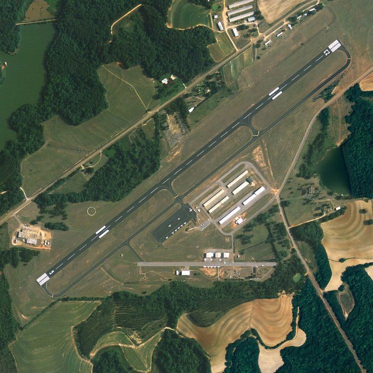
Enterprise Municipal Airport (IATA: ETS, ICAO: KEDN, FAA LID: EDN) is a city owned, public use airport located three nautical miles (6 km) west of the central business district of Enterprise, a city in Coffee County, Alabama, United States. It is included in the National Plan of Integrated Airport Systems for 2011–2015, which categorized it as a general aviation facility.
This airport is assigned a three-letter location identifier of EDN by the Federal Aviation Administration, but the International Air Transport Association (IATA) airport code is ETS.
An EF4 tornado impacted near this area on March 1, 2007 before destroying the high school.
Facilities and aircraft
Enterprise Municipal Airport covers an area of 90 acres (36 ha) at an elevation of 361 feet (110 m) above mean sea level. It has one runway designated 5/23 with an asphalt surface measuring 5,080 by 100 feet (1,548 x 30 m).
For the 12-month period ending January 25, 2010, the airport had 43,456 aircraft operations, an average of 119 per day: 58% military and 42% general aviation. At that time there were 52 aircraft based at this airport: 81% single-engine, 14% multi-engine, 2% helicopter, and 4% ultralight.