
Country South Africa Seat Ngcobo Time zone SAST (UTC+2) Area 2,484 km² Local time Friday 8:20 PM | Province Eastern Cape Wards 20 Municipal code EC137 White population 0.1% | |
 | ||
Weather 12°C, Wind E at 13 km/h, 80% Humidity District Chris Hani District Municipality | ||
Engcobo Local Municipality is an administrative area in the Chris Hani District of the Eastern Cape in South Africa. Ngcobo is an isiXhosa name for a sweet grass found in the area.
Contents
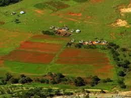
Map of Engcobo, 5050, South Africa
Main places
The 2001 census divided the municipality into the following main places:
Politics
The municipal council consists of thirty-nine members elected by mixed-member proportional representation. Twenty councillors are elected by first-past-the-post voting in twenty wards, while the remaining nineteen are chosen from party lists so that the total number of party representatives is proportional to the number of votes received. In the election of 3 August 2016 the African National Congress (ANC) won a majority of thirty-three seats on the council. The following table shows the results of the election.