
Postcode(s) 5085 | Postal code 5085 | |
 | ||
Enfield is a suburb in Adelaide, Australia. The suburb is about a 10-minute drive north from Adelaide CBD. (Central Business District). The suburb is bordered by Gepps Cross, Blair Athol and Clearview at the Northern end, and Prospect, Sefton Park and Broadview at the Southern end.
Contents
Map of Enfield SA 5085, Australia
History
Enfield was established as a village in 1843 by George Hickox as group of 44 quarter-acre blocks. Hickox named the village after his birthplace in Middlesex, United Kingdom. The name "Enfield" is derived from the Anglo-Saxon word "enedfeld" meaning "duck field".
Two houses in Enfield, Pine Forest in Gurney Terrace and Barton Vale in Walker Court, are listed on the South Australian Heritage Register.
Government
Enfield is governed by the City of Port Adelaide Enfield council at Local Government levell. The council has one of its main offices located in the Enfield Public Library. The council began operating in 1996. The Council's main office is located in Port Adelaide.
At state government level, Enfield is contained in the state electoral district of Enfield.
The Enfield electorate was first created in 1956-1970 and then later re-established as a part of the 1998 electorate redistributions. Another redistribution in 2003 resulted in the alteration of the southern border.
Education
Enfield has 3 main schools, Enfield High School and Enfield Primary School. Enfield High is partners with Blair Athol Senior School and is located on Grand Junction Road. Year levels start from 7 - 12. Enfield Primary is located near Enfield High and year levels start from 1 - 6. St Gabriel's School, Whittington Street Enfield, is a Catholic Primary school with enrolments from Reception to Year 7. It is the parish school of the Good Shepherd church, Clearview.
Shopping
Enfield has a small shopping centre located near The Enfield Library. The shopping centre has an IGA supermarket and Casual Living furniture store. The centre also has a salon, a bakery, barber and The Enfield Post Office.
The southern end of Enfield is well serviced by Northpark Shopping Centre, Regency Plaza and Sefton Plaza which are located in the neighbouring suburbs of Prospect and Sefton Park.
Transport
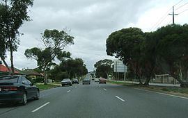
Bus routes 221, 222, 224, 225, 226, 228 and 229 travel from Adelaide CBD to various destinations in the northern suburbs, via Main North Road, on Enfield's western boundary. Circle Line route 300 services Regency Road on the southern boundary of Enfield and links the suburb with various destinations, such as Arndale Shopping Centre and Norwood. Bus routes 237 and 361 travel along Grand Junction Road on the northern boundary of Enfield to Port Adelaide, Valley View and Tea Tree Plaza.