
Country Canada Time zone PST (UTC-8) Elevation 360 m Population 2,932 (2011) | Region OkanaganShuswap Incorporated 1905 Area 4.26 km² Local time Friday 5:30 AM | |
 | ||
Founded 1866, by Alexander Leslie Fortune (first white settler) Weather -2°C, Wind NW at 0 km/h, 99% Humidity | ||
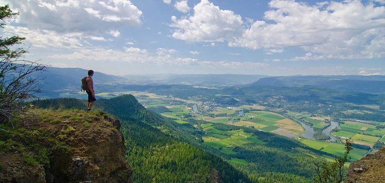
Exploring enderby british columbia winter
The City of Enderby is in the North Okanagan region of the Canadian province of British Columbia, between Armstrong and Salmon Arm. It is approximately 80 km north of Kelowna and 130 km east of Kamloops. Highway 97A passes through Enderby and the Shuswap River marks the eastern and northeastern limits of the City. There are two major schools in Enderby: M.V. Beattie Elementary School and A.L. Fortune Secondary School. M.V. Beattie Elementary School was rebuilt in 2012.
Contents
- Exploring enderby british columbia winter
- Map of Enderby BC Canada
- Geography
- Economy
- Sports and recreation tourism
- Places of interest
- Splatsin Band
- In popular culture
- References
Map of Enderby, BC, Canada
The rural area surrounding Enderby is made up of the communities of Ashton Creek, Grandview Bench, Grindrod, Kingfisher, Mara, Splatsin Reserve, Springbend and Trinity Valley. The rural area is 2,108.46 square kilometres. Several smaller lakes, including Gardom Lake and Hidden Lake, are also located in the area.
Geography
Latitude-Longitude: 50°33′03.0″N 119°08′22.7″W elevation: 360 metres
Economy
Agriculture, industry, retail, and tourism are the main components of the economy.
A variety of agricultural and industrial enterprises are located in the area, including dairy farming, cattle ranching, fertilizer and feed production, mills, and value-added wood products. Farms include diverse livestock such as llamas, bison, and deer.
Sports and recreation tourism
Enderby is known for the variety of outdoor activities, including tubefloating, hiking, canoeing and kayaking, golfing, snowmobiling, and cross-country skiing. It is home to the Enderby Memorial Arena and Curling Rink, ball diamonds, and an outdoor public pool.
The Enderby Cliffs, a BC Provincial Park, is a popular hiking destination. Other hiking destinations include Mara Provincial Park and Larch Hills. The Shuswap River is known for its tubefloating, canoeing and kayaking. It hosted the Canoe Nationals in 2008. The Kingfisher Kayak Rodeo is held annually. There are two golf courses in the area: Mabel Lake Golf & Country Club and Birchdale Golf Course. To the east of Enderby is Hunters Range Trail System, a snowmobile range with approximately 200 square kilometres trails. Also in the area is the Larch Hills Cross Country Ski Trails.
Places of interest
Enderby and the surrounding area is home to the world's largest reel lawnmower, built and hosted by the Deep Creek Tool Museum, and the largest drive-in movie theatre screen in North America at the Starlight Drive-In Theatre. Also located in the area is the Enderby Museum & Archives and the Kingfisher Interpretive Centre, a salmon hatchery and watershed learning centre.
Splatsin Band
The Splatsin Band is the original inhabitant of the area. It is the southernmost tribe of the Secwepemc or Shuswap Nation. The Splatsin Band, occasionally anglicized as "Spallumcheen," is governed by an elected Chief and Council.
In popular culture
Portions of the films Tomorrowland and Blackway were shot within Enderby and the surrounding areas in August 2013 and November 2014, respectively.
On February 17, 2015, Miss P, a 4-year-old Beagle from Enderby, won Best in Show at the 2015 Westminster Kennel Club all-breed dog show at Madison Square Garden in New York.