
Area 8.37 km² | Canton Villefagnan Population (2008) 120 Local time Friday 9:29 AM | |
 | ||
Weather 12°C, Wind NE at 6 km/h, 83% Humidity | ||
Empuré is a commune in the Charente department in southwestern France.
Contents
Map of 16240 Empur%C3%A9, France
Bounded on the west by the Fountaine de Frédières, a small tributary of the Aume, the town lies on a plateau, located 3 km northwest of Villefagnan and 13 km west of Ruffec. The main crop is cereals.
The main route is the D27 route which crosses the commune from the north-west to south-east, which passes near the town of Empuré. The communes contains the hamlets Planchard in the west bordering the commune of Paizay-Naudouin-Embourie, Le Pouyaud to the north of the town and Bellevue etc.
Sights
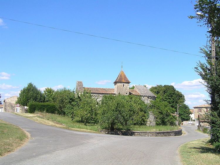
Église Saint-Maixent, a remarkable building from the twelfth century is characterised by its arched gateway, and the symbolic corbels that adorn its façade. It was classified a historical monument on May 9, 1914.
There is also a chateau in the commune and a town hall, built in the 16th century.