
- left Little Emory River - elevation 2,450 ft (747 m) Length 26 km Country United States of America | - elevation 741 ft (226 m) Basin area 2,258 km² | |
 | ||
- average 1,466 cu ft/s (42 m/s) (mean for water years 1927-1983) - max 195,000 cu ft/s (5,522 m/s) March 1929 | ||
Tva coal ash spill emory river tennessee
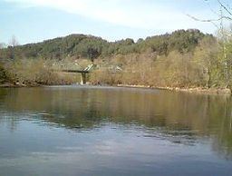
The Emory River is a river draining a portion of Tennessee's Cumberland Plateau. It flows for just over 46 miles (74 km) from its source near Frozen Head State Park to its mouth along the Clinch River at Kingston, Tennessee.
Contents
- Tva coal ash spill emory river tennessee
- Map of Emory River Tennessee USA
- Clear creek canyon obed wild scenic river emory river tn
- HydrographyEdit
- EtymologyEdit
- References
Map of Emory River, Tennessee, USA
Clear creek canyon obed wild scenic river emory river tn
HydrographyEdit
The Emory River rises on the slopes of Fork Mountain and descends through valley along the northern base of Bird Mountain, a prominent ridge in Frozen Head State Park in Morgan County. The surrounding area has been the subject of extensive strip mining for coal which has resulted in some stream pollution. The stream initially flows basically westward and is crossed by U.S. Highway 27. Turning more southwestward, it is paralleled for a time by a line of the Norfolk Southern Railway. It meets the Obed River in the southeast corner of the expansive Catoosa Wildlife Management Area, a large game-management area operated by the Tennessee Wildlife Resources Agency.
Still paralleled by the railroad, the stream crosses into Roane County near Harriman. Backwaters of the Watts Bar Lake impoundment of the Tennessee River cause the water below Harriman to be somewhat slack. The Little Emory River is also impounded somewhat above its mouth into the Emory below Harriman.
The mouth of the Emory is into the Clinch River at the Tennessee Valley Authority's Kingston Power Plant, a coal-fired electric generation station initially developed during World War II, largely to power the uranium enrichment plants used to make the world's first atomic bomb at nearby Oak Ridge National Laboratory. The 2008 Kingston Fossil Plant coal fly ash slurry spill heavily polluted the Emory River and surrounding area.
EtymologyEdit
According to a 1910 article in the Rockwood Times by Captain William E. McElwee, the river was named after "William Emery", an early traveler who drowned while swimming the river with his "accoutrements" on. Early deed books sometimes refer to this as "William Emeries River". The Indian name for the Emory River was "Babahatchie", which means "babbling waters."