
Country United States County Ellis ZIP code 67640 Elevation 611 m | State Kansas Time zone Central (CST) (UTC-6) Area code(s) 785 | |
 | ||
Emmeram is an unincorporated community in Herzog Township, Ellis County, Kansas, United States.
Contents
Map of Emmeram, Herzog, KS 67671, USA
History
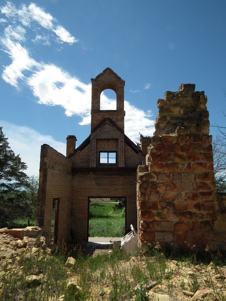
In 1899, Catholic parishioners from nearby Herzog established a new parish six miles to the north and began construction of Sacred Heart Church, which they completed in 1901. Originally named Norddorf, the community was renamed Emmeram after Emmeram Kausler, the church pastor. The community grew to include two schools, and a town plot was filed in 1902, but the town was never built. A post office operated in Emmeram from 1903 to 1904.
Geography
Emmeram is located at 38°57′31″N 99°07′56″W (38.9586225, -99.1323179) at an elevation of 2,005 feet (611 m). It lies approximately one-half mile northeast of Walker Creek, part of the Smoky Hill River watershed, in the Smoky Hills region of the Great Plains. Emmeram is roughly 5.5 miles (9 km) north of Interstate 70 and 11 miles (18 km) northeast of Hays, the county seat.
Transportation
Emmeram lies at the intersection of two unpaved county roads, Emmeram Road, which runs east-west, and 350th Avenue, which runs north-south.