Neha Patil (Editor)

Elle (river)

Updated on
Edit
Like
Comment
Share on FacebookTweet on TwitterShare on LinkedInShare on Reddit
Progression
  
Vire→ English Channel

Tributaries
  
Right: Rieu

Country
  
France

Basin size
  
129 km (50 sq mi)

Length
  
32 km

Elle (river) httpsuploadwikimediaorgwikipediacommonsthu

Main source
  
Les Navignes, Rouxeville 165 m (541 ft)

River mouth
  
Vire, Neuilly-la-Forêt 1 m (3.3 ft)

Discharge
  
Average rate: 0.628 m/s (22.2 cu ft/s)  (Saint-Jean-de-Savigny)

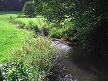
The Elle is a 31.8 km long river in Normandy, a right bank affluent of the Vire.

Contents

Map of L'Elle, France

TopographyEdit

It crops north of Rouxeville. It joins la Vire (river) at Neuilly-la-Forêt in the Marais du Cotentin et du Bessin between Bessin and Pays saint-lois.

TributariesEdit

L'Elle has several affluents ~ among them:

  • one main affluent : the Rieu (12.2 km) which joins right bank at Lison. The Rieu collects the waters of the north-eastern part of the basin, located between those of l'Aure (north) and the Vire (east) and a few of its tributaries to the south and the east.
  • le ruisseau de Branche (6.7 km) joins the Elle left bank at Saint-Jean-de-Savigny.
  • CommunesEdit

  • Rouxeville (spring source at 200 m),
  • Saint-Germain-d'Elle,
  • Bérigny, où se joignent des ramifications secondaires venant de Saint-Jean-des-Baisants et Notre-Dame-d'Elle,
  • Saint-Georges-d'Elle (en limite est),
  • Montfiquet (en limite ouest),
  • Cerisy-la-Forêt,
  • Sainte-Marguerite-d'Elle (en limite sud),
  • Saint-Jean-de-Savigny (en limite nord),
  • Saint-Clair-sur-l'Elle (en limite nord),
  • Moon-sur-Elle,
  • Airel,
  • Lison (en limite ouest),
  • Neuilly-la-Forêt (confluent avec la Vire),
  • References

    Elle (river) Wikipedia