
Country Canada Postal code span V0B 1H0 Area 101.6 km² Local time Thursday 12:42 AM | Region Rockies Incorporated 1971 Elevation 1,300 m Population 2,523 (2011) | |
 | ||
Time zone Mountain Standard (MST) (UTC-7) Weather -18°C, Wind NW at 6 km/h, 93% Humidity | ||
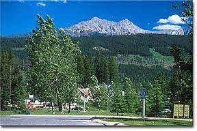
Looking around elkford bc s municipal campground aug 15
Elkford is a district municipality in the southeast region of the Canadian province of British Columbia in the Rocky Mountain range, with a population of about 2,500. It is 32 km north of the junction at Sparwood, on provincial Highway 43. Outdoor recreational activities take place at Elkford throughout the year.
Contents
- Looking around elkford bc s municipal campground aug 15
- Map of Elkford BC Canada
- Elkford summer
- Radio stations
- Cable television stations
- References
Map of Elkford, BC, Canada
The town and area has many kilometers of horse riding, hiking, snowmobiling and cross country ski trails, and a ski hill, Wapiti, run by Elkford resident volunteers. The Elkford Aquatic Centre has a competition-size pool, hot tub and sauna.
There are two public schools Rocky Mountain Elementary School and Elkford Secondary School with a combined student population of 400 in January 2006.
There are five open-pit coal mines within an hour's drive of Elkford: Fording River Operations (FRO), Greenhills Operations (GHO), Line Creek Operations (LCO), Elkview Operations (EVO) and Coal Mountain Operations (CMO). All mines belong to Teck Resources. Elkford was created, due to mining activity, in the early 1970s. Many Elkford residents work for the mines or as contractors; other residents work in service industries directly related to the mines.
A coal seam close to Aldridge Creek, north of Elkford, has been burning for decades.[1]