
Area 109.3 km² Established October 2, 1968 | Nearest city West Plains | |
 | ||
Management United States Forest Service | ||
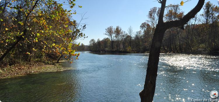
The Eleven Point National Wild and Scenic River is a 44-mile (71 km) stretch of the spring-fed Eleven Point River in the Ozarks of southern Missouri set aside through eminent domain for preservation by Congress in 1968. The designated part of the river stretches from Thomasville to State Highway 142. The river was included in the original proposal for the Ozark National Scenic Riverways, but it was ultimately excluded when the Riverways were designated on the Current and Jacks Fork rivers in 1964.
It is one of the original eight rivers named under the Wild and Scenic Rivers Act as possessing "outstandingly remarkable scenic, recreational, geologic, fish and wildlife, historic, cultural or other similar values." The Eleven Point holds the scenic designation within the National Wild and Scenic Rivers system, meaning that it is free of impoundments, with shorelines or watersheds still largely primitive and shorelines largely undeveloped, but accessible in places by roads. The river isn't actually wilderness, many old homesites, fences, farms, and roads were located along the river, but in only a few decades have since been reclaimed by nature. Only about half of the land in the designated area is public, owned by the National Forest Service. The government holds a scenic easement on other land within the area that preserves its character for the future, but which does not allow public access to privately held land.
Being a river, naturally, the area is best visited by boat. Canoeing is the most popular way to visit, while jon boats are frequently used by fishermen. Smallmouth bass, rock bass, walleye, and trout are among a variety game fish found in the river. There are minimally developed float camps along the river that are accessible by boat, and dispersed camping on gravel bars is allowed.
Greer Spring and a corridor along its sizable spring branch were added to the Wild and Scenic River at a later date.
Remains of mills and small dams are found on springs and branches along the river. At Turner Spring, a 25-feet in diameter mill wheel stands upright in the spring branch, as well as rockwork and foundations of the former millsite. Boze Mill Spring has a very old dam and turbine. A dam stands at the old Morgan Spring aquatic plant farm area of the Narrows area near Billmore. Several smaller and less notable dam remains can be found by further exploration.Built in 1899, high atop a ridge, stands Greer Mill. Greer Mill is currently undergoing a restoration conducted by the U.S. Forest Service.
Eleven Point State Park is in development. Primarily located on the historic Pigman Ranch, near Riverton, the state park will offer camping, hiking, and other recreational activities. The opening date is undetermined.
On foot or horseback, the river can be visited via the Eleven Point Section of the long distance Ozark Trail or the White's Creek Trail that loops through the Irish Wilderness. Both trails have numerous overlooks and meander next to the river for several miles.